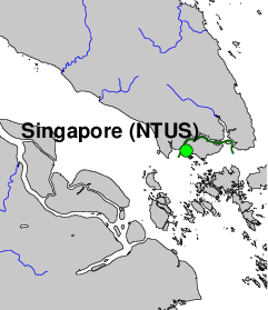
Nanyang Technological University (NTUS), Singapore
GNSS contact: Hans van der Marel, TUD/LR/DEOS
GNSS Instrument(s)
| Name | Marker | Receiver | Antenna | Operator | Network | Start date | End date |
|---|
| ntus | 22601M001 | LEICA GR50 | LEIAR20 | TUD/CITG/GRS,LEICA | IGS | 1997-06-26 | |
Markers
| ID | Name | dX | dY | dZ | Instruments | Installed | Removed |
|---|
| 22601M001 | NTUS-01 | 0.0000 | 0.0000 | 0.0000 | ntus | 1997-06-26T03:00Z | |
Pictures
Active instruments
Marker ID: 22601M001
Operator: Leica Geosystems Singapore
Log file:
ntus00sgp_20250522.log
Receiver
| Installed | week/d doy | Removed | week/d doy | Receiver type | S/N | Firmware |
|---|
| 1997-06-26T03:00Z | 0911/4 177 | 1999-09-02T00:00Z | 1025/4 245 | ROGUE SNR-8000 | 175 | 3.2.32.1 |
| 1999-10-28T06:00Z | 1033/4 301 | 2000-10-20T00:00Z | 1084/5 294 | AOA SNR-12 ACT | 229 | 3.3.32.3 |
| 2001-02-22T05:20Z | 1102/4 053 | 2001-03-11T00:00Z | 1105/0 070 | AOA SNR-12 ACT | 224 | 3.3.32.3 |
| 2001-06-18T03:40Z | 1119/1 169 | 2006-11-03T00:00Z | 1399/5 307 | AOA SNR-12 ACT | 225 | 3.3.32.4 |
| 2007-06-01T00:00Z | 1429/5 152 | 2007-09-20T10:40Z | 1445/4 263 | LEICA GRX1200GGPRO | 352729 | 5.10/3.013 |
| 2007-09-20T10:58Z | 1445/4 263 | 2007-11-21T02:50Z | 1454/3 325 | LEICA GRX1200GGPRO | 352729 | 5.50/ |
| 2007-11-21T02:50Z | 1454/3 325 | 2008-03-07T07:00Z | 1469/5 067 | LEICA GRX1200GGPRO | 352729 | 5.60/3.014 |
| 2008-03-07T07:00Z | 1469/5 067 | 2009-09-03T07:24Z | 1547/4 246 | LEICA GRX1200GGPRO | 352729 | 5.62/3.014 |
| 2009-09-03T07:45Z | 1547/4 246 | 2010-04-05T08:30Z | 1578/1 095 | LEICA GRX1200GGPRO | 352729 | 7.53/3.015 |
| 2010-04-05T08:30Z | 1578/1 095 | 2010-05-10T06:53Z | 1583/1 130 | LEICA GRX1200GGPRO | 352729 | 7.80/3.018 |
| 2010-05-10T07:04Z | 1583/1 130 | 2011-01-25T03:14Z | 1620/2 025 | LEICA GRX1200GGPRO | 352729 | 7.80/3.019 |
| 2011-01-25T06:28Z | 1620/2 025 | 2014-07-27T03:00Z | 1803/0 208 | LEICA GRX1200GGPRO | 352729 | 8.10/3.019 |
| 2014-12-20T09:06Z | 1823/6 354 | 2017-04-24T07:50Z | 1946/1 114 | LEICA GRX1200GGPRO | 352729 | 8.10/3.055 |
| 2017-04-24T08:00Z | 1946/1 114 | 2018-04-18T02:40Z | 1997/3 108 | LEICA GRX1200GGPRO | 352729 | 9.20/3.823 |
| 2018-04-18T02:50Z | 1997/3 108 | 2021-11-25T10:40Z | 2185/4 329 | LEICA GR50 | 1832415 | 4.20/7.300 |
| 2021-11-25T10:40Z | 2185/4 329 | 2022-02-14T01:24Z | 2197/1 045 | LEICA GR50 | 1832415 | 4.51/7.710 |
| 2022-02-14T01:24Z | 2197/1 045 | 2022-08-03T05:19Z | 2221/3 215 | LEICA GR50 | 1832415 | 4.52/7.711 |
| 2022-08-03T05:19Z | 2221/3 215 | 2022-11-23T02:06Z | 2237/3 327 | LEICA GR50 | 1832415 | 4.60/7.811 |
| 2022-11-23T02:06Z | 2237/3 327 | 2023-08-15T18:23Z | 2275/2 227 | LEICA GR50 | 1832415 | 4.61/7.811 |
| 2023-08-15T18:23Z | 2275/2 227 | 2024-02-14T18:14Z | 2301/3 045 | LEICA GR50 | 1832415 | 4.70/7.813 |
| 2024-02-14T18:14Z | 2301/3 045 | 2025-01-08T06:05Z | 2348/3 008 | LEICA GR50 | 1832415 | 4.80/7.900 |
| 2025-01-08T06:05Z | 2348/3 008 | 2025-05-21T07:37Z | 2367/3 141 | LEICA GR50 | 1832415 | 4.82/7.900 |
| 2025-05-21T07:37Z | 2367/3 141 | | | LEICA GR50 | 1832415 | 4.83/7.900 |
Antenna
| Installed | week/d doy | Removed | week/d doy | Antenna type | Dome | S/N | Height | Antenna calibration |
|---|
| 1997-06-26T03:00Z | 0911/4 177 | 1998-05-07T08:00Z | 0956/4 127 | AOAD/M_T | NONE | 177 | 0.0776 | AOAD-M_T_RFI____NONE_177.atx |
| 1998-06-08T00:00Z | 0961/1 159 | 2007-05-16T00:00Z | 1427/3 136 | AOAD/M_T | NONE | 222 | 0.0776 | AOAD-M_T_RFI____NONE_222.atx |
| 2007-05-16T00:00Z | 1427/3 136 | 2018-04-18T02:40Z | 1997/3 108 | LEIAT504GG | NONE | 200240 | 0.0776 | |
| 2018-04-18T02:50Z | 1997/3 108 | | | LEIAR20 | LEIM | 20288014 | 0.0776 | |
External Frequency
| Installed | week/d doy | Removed | week/d doy | Ext. Frequency type |
|---|
| 1997-06-26T03:00Z | 0911/4 177 | | | INTERNAL |
Notes
- 1997-06-26T03:00Z 0911/4 177 - 2010-10-05T00:00Z 1604/2 278
- NTUS is operated jointly for IGS by Singapore Land Authority (SLA)
and the Delft University of Technology (DUT/DEOS).
- 1997-06-26T03:00Z 0911/4 177 - 2006-11-03T00:00Z 1399/5 307
- No rawdata files are available for the following periods (week/dow):
until 999/6; 1011/2-1068/5; 1083/2; 1226/2-1232/3; 1310/4-1318/1;
1320/0-1321/1;1322/1-1323/0;1327/6-1329/2;1371/4; 1372/2 and 1372/3.
Also, there are gaps in the rinex data for this period.
- 1997-06-26T03:00Z 0911/4 177 - 2007-05-16T00:00Z 1427/3 136
- The antenna is mounted on a pillar with a SOKIA Tribrach.
The pillar (approx. 1.50m high) is located on the building
of the Survey Laboratory of the School of Civil and Structural
Engineering of the Nanyang Technological
University at Singapore
- 2006-11-03T00:00Z 1399/5 307 - 2007-05-16T00:00Z 1427/3 136
- At the time the AOA_DM/T antenna was dismantled, the antenna was warbling
as the tribrach and adaptor was not secure due to wear and tear. The
antenna was also orientated to the East instead of North based on the
position of the cable connector. It is not known since when this condition
existed, but we suspect it happened at the end of life of the AOA
Turbo Rogue receiver (after this receiver stopped functioning). However,
it may have affected the time series at the end of 2006.
- 2007-05-16T00:00Z 1427/3 136 -
- The antenna is mounted on a pillar with a LEICA GDF 111-1
Tribrach and rotatable Tribrach adapter (replacing the damaged
SOKIA Tribrach and adapter). The new antenna was installed at
a height within a accuracy of 0.5mm compared to the previously
installed antenna. It was also orientated to the North within
+/-2deg.
The pillar (approx. 1.50m high) is located on the building
of the Survey Laboratory of the School of Civil and Structural
Engineering of the Nanyang Technological University at Singapore.
There is another choke ring antenna with radome, one of the 5 national
permanent reference stations, about 2m away. There is a
lightning arrestor on the same roof about 4m away.
Before the installation of the LEICA antenna, the pillar, received
some minor rust-proofing cum painting work and heat shielding
(with a pvc pipe with holes).
- 2010-10-05T00:00Z 1604/2 278 -
- Singapore Land Authority (SLA) has taken over the operation of
the station from Nanyang Technological University (NTU)
- 2014-07-27T03:00Z 1803/0 208 - 2014-12-20T09:06Z 1823/6 354
- Receiver did not track satellites during this period due to firmware problem.
Firmware was upgraded on 20 Dec 2014 and receiver started tracking again.
- 2015-04-05T04:00Z 1839/0 095 - 2016-04-04T13:33Z 1891/1 095
- The LDC is not receiving any data due to unresolved and unknown issues.
- 2016-04-04T13:33Z 1891/1 095 - 2016-05-17T08:00Z 1897/2 138
- The receiver is on-line again after installing a cellular modem and internet configuration. There is however an issue with the data, at regular intervals
the receiver is not tracking any satellites.
- 2016-05-17T08:00Z 1897/2 138 - 2017-03-08T09:00Z 1939/3 067
- The LDC is not receiving any data due to unresolved and unknown issues.
- 2017-03-08T09:00Z 1939/3 067 - 2017-04-19T19:00Z 1945/3 109
- Connection to receiver has been restored and receiver is sending data again after a new antenna cable was installed. However, there during periods of the
day the receiver is not tracking any data. After some time GLONASS was disabled to due some further checking, but this did not resolve the problem. On
19 April 2017 an attempt was made to upgrade the f/w to version 9.20/3.823, but failed, leaving the receiver in an inoperative state. On April 24 2017
the receiver was physically reset and f/w upgrade to version 9.20/3.823 was made.
The data that was received during this period is available at the LDC, but has not been uploaded to IGS.
- 2017-03-08T09:00Z 1939/3 067 -
- Uploads to IGS have been restarted after the upgrade to f/w version 9.20/3.823.
For more information contact Hans van der Marel.