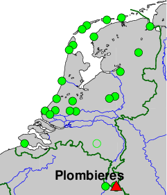
Integrated Geodetic Reference Stations (IGRS), Plombieres, Belgium.
On-site contact: Anne Orban, CSL, Universite de Liege
GNSS contact: Hans van der Marel, TUD/GRS
GNSS Instrument(s)
| Name | Marker | Receiver | Antenna | Operator | Network | Start date | End date |
|---|
| pbcm | 13177M001 | LEICA GR50 | LEIAR20 | CSL | IGRS | 2023-02-06 | |
| pblb | 13177M002 | LEICA GR50 | LEIAR20 | CSL | IGRS | 2023-02-06 | |
Markers
| ID | Name | dX | dY | dZ | Instruments | Installed | Removed |
|---|
| 13177M001 | BOTTOM OF IGRS MAST (CEMETRY) | 0.0000 | 0.0000 | 0.0000 | pbcm | 2023-02-06T15:00Z | |
| 13177M002 | BOTTOM OF IGRS MAST (LIBRARY) | 136.9900 | -171.5700 | -95.8300 | pblb | 2023-02-06T12:00Z | |
Pictures
Active instruments
Marker ID: 13177M001
Operator: UNIVERSITE DE LIEGE
Log file:
pbcm00bel_20230825.log
Receiver
| Installed | week/d doy | Removed | week/d doy | Receiver type | S/N | Firmware |
|---|
| 2023-02-06T15:17Z | 2248/1 037 | 2023-08-18T14:45Z | 2275/5 230 | LEICA GR50 | 1871735 | 4.61/7.811 |
| 2023-08-18T14:45Z | 2275/5 230 | | | LEICA GR50 | 1871735 | 4.70/7.813 |
Antenna
| Installed | week/d doy | Removed | week/d doy | Antenna type | Dome | S/N | Height | Antenna calibration |
|---|
| 2023-02-06T15:17Z | 2248/1 037 | | | LEIAR20 | LEIM | 24337015 | 2.5244 | |
External Frequency
| Installed | week/d doy | Removed | week/d doy | Ext. Frequency type |
|---|
| 2023-02-06T15:17Z | 2248/1 037 | | | INTERNAL |
Notes
- 2023-02-06T15:17Z 2248/1 037 -
- The GNSS instrument mechanically connected to two 90 cm trihedral corner reflectors for
co-locating (In)SAR ascending and descending radar observations. The GNSS monument
itself consists of a SECO mount, on top of a 2.5 m heigh 8 cm diameter stainless steel
pipe, with a 35 cm square strudded footplate. On each side, a 90 cm corner reflector for
ascending and descending InSAR tracks is attached. 1.418 m below the GNSS monument a
GCP for LIDAR measurements (the top plate of the IGRS) is present. The whole assembly
is mounted on a 2.5 m (E-W oriented) x 0.8 m (N-S) x 0.35 m concrete plate.
The top plate of the IGRS (LIDAR GCP) is 1.1079 meter above the NGI levelling marker in the concrete block, the GNSS ARP
is 1.418 m above the top-plate (LIDAR GCP) and 2.5244 m above the NGI levelling marker
- 2023-02-06T15:17Z 2248/1 037 - 2023-08-18T14:45Z 2275/5 230
- On 18 Aug 2023 the definition of the marker was changed. Instead of the ARP the marker is now a composite point at the bottom
of the pole. The new marker is 2.5302 m below the current ARP. The horizontal position is defined by the vertical through
the center of the 5/8" thread of the SECO mount in the top of the mast, the vertical level of the marker is defined by the NGI levelling marker
in the concrete plate.
On 18 Aug 2023 the settings in the receiver have been adjusted (new coordinates and antenna height). All RINEX files before this
date have been adjusted to the new definition.
- 2022-12-19T12:00Z 2241/1 353 - 2023-02-06T15:00Z 2248/1 037
- The IGRS was mounted on the concrete plate but not yet properly alligned. InSAR data for the CR is not to be used for this period.
Marker ID: 13177M002
Operator: UNIVERSITE DE LIEGE
Log file:
pblb00bel_20230825.log
Receiver
| Installed | week/d doy | Removed | week/d doy | Receiver type | S/N | Firmware |
|---|
| 2023-02-06T12:04Z | 2248/1 037 | 2023-08-18T14:40Z | 2275/5 230 | LEICA GR50 | 1871737 | 4.61/7.811 |
| 2023-08-18T14:40Z | 2275/5 230 | | | LEICA GR50 | 1871737 | 4.70/7.813 |
Antenna
| Installed | week/d doy | Removed | week/d doy | Antenna type | Dome | S/N | Height | Antenna calibration |
|---|
| 2023-02-06T12:04Z | 2248/1 037 | | | LEIAR20 | LEIM | 24337016 | 2.5302 | |
External Frequency
| Installed | week/d doy | Removed | week/d doy | Ext. Frequency type |
|---|
| 2023-02-06T12:04Z | 2248/1 037 | | | INTERNAL |
Notes
- 2023-02-06T12:04Z 2248/1 037 - 2023-08-18T14:40Z 2275/5 230
- On 18 Aug 2023 the definition of the marker was changed. Instead of the ARP the marker is now a composite point at the bottom
of the pole. The new marker is 2.5302 m below the current ARP. The horizontal position is defined by the vertical through
the center of the 5/8" thread of the SECO mount in the top of the mast, the vertical level of the marker is defined by the NGI levelling marker
in the concrete plate.
On 18 Aug 2023 the settings in the receiver have been adjusted (new coordinates and antenna height). All RINEX files before this
date have been adjusted to the new definition.
- 2023-02-06T12:04Z 2248/1 037 -
- The GNSS instrument mechanically connected to two 90 cm trihedral corner reflectors for
co-locating (In)SAR ascending and descending radar observations. The GNSS monument
itself consists of a SECO mount, on top of a 2.5 m heigh 8 cm diameter stainless steel
pipe, with a 35 cm square strudded footplate. On each side, a 90 cm corner reflector for
ascending and descending InSAR tracks is attached. 1.418 m below the GNSS monument a
GCP for LIDAR measurements (the top plate of the IGRS) is present. The whole assembly
is mounted on a 2.5 m (E-W oriented) x 0.8 m (N-S) x 0.35 m concrete plate.
The top plate of the IGRS (LIDAR GCP) is 1.1079 meter above the NGI levelling marker in the concrete block, the GNSS ARP
is 1.417 m above the top-plate (LIDAR GCP) and 2.5302 m above the NGI levelling marker
- 2022-12-19T12:00Z 2241/1 353 - 2023-02-06T12:00Z 2248/1 037
- The IGRS was mounted on the concrete plate but not yet properly alligned. InSAR data for the CR is not to be used for this period.
For more information contact Hans van der Marel.