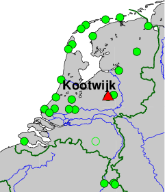
Kootwijk Observatory for Satellite Geodesy (KOSG), Kootwijk, The Netherlands.
On-site contact: AGRS.NL team, Kadaster, +31652481939
GNSS contact: Hans van der Marel, TUD/LR/DEOS
GNSS Instrument(s)
| Name | Marker | Receiver | Antenna | Operator | Network | Start date | End date |
|---|
| kosa | 13504M003 | TRIMBLE 4700 | AOAD/M_B | NSGI | AGRS.NL | 1996-04-23 | 2001-01-30 |
| kosg | 13504M003 | LEICA GRX1200GGPRO | AOAD/M_B | TUD/CITG/GRS | IGS,EPN | 1994-06-13 | 2015-11-27 |
| kos1 | 13504M005 | SEPT POLARX5E | LEIAR25.R3 | NSGI | IGS,EPN | 2013-06-18 | |
| kos2 | 13504M003 | LEICA GRX1200GGPRO | AOAD/M_B | TUD/CITG/GRS | NONE | 2008-07-31 | 2008-08-28 |
Markers
| ID | Name | dX | dY | dZ | Instruments | Installed | Removed |
|---|
| 13504M003 | GPS mark 339334-25 | 0.0000 | 0.0000 | 0.0000 | kosa,kosg,kos2 | 1994-01-01T12:00Z | 2013-03-07T12:00 |
| 13504M005 | GPS mark 339352-02 | 388.5300 | 630.9300 | -339.5800 | kos1 | 2013-06-18T12:44Z | |
Pictures
Notes
- 2013-05-23T00:00Z 1741/4 143 -
- Marker 13504M005 is co-located (within 10 meter) with a facility for measuring absolute
gravity and an underground (primary) marker of the national levelling network (NAP).
Absolute gravity is measured yearly using a Micro-g FG-5 (#234).
- 2013-06-26T09:00Z 1746/3 177 - 2013-06-27T16:00 1746/4 178
- A local survey and levelling have been conducted to obtain the eccentricities for the
new marker 13504M005.
Active instruments
Marker ID: 13504M005
Operator: Kadaster
Log file:
kos100nld_20260219.log
Receiver
| Installed | week/d doy | Removed | week/d doy | Receiver type | S/N | Firmware |
|---|
| 2013-06-18T12:44Z | 1745/2 169 | 2013-09-09T02:00Z | 1757/1 252 | SEPT POLARX4 | 3002129 | 2.3.4 |
| 2013-09-10T09:58Z | 1757/2 253 | 2015-02-18T16:00Z | 1832/3 049 | SEPT POLARX4 | 3002129 | 2.5.2 |
| 2015-02-18T16:00Z | 1832/3 049 | 2015-06-18T08:43Z | 1849/4 169 | SEPT POLARX4 | 3002129 | 2.7-beta1 |
| 2015-06-18T08:43Z | 1849/4 169 | 2017-01-18T15:04Z | 1932/3 018 | SEPT POLARX4 | 3002129 | 2.9.0 |
| 2017-01-18T15:04Z | 1932/3 018 | 2017-01-18T19:45Z | 1932/3 018 | SEPT POLARX4 | 3002129 | 2.9.5 |
| 2017-01-18T19:04Z | 1932/3 018 | 2018-12-17T12:45Z | 2032/1 351 | SEPT POLARX4 | 3002129 | 2.9.6 |
| 2018-12-17T12:49Z | 2032/1 351 | 2020-04-20T07:30Z | 2102/1 111 | SEPT POLARX4 | 3002129 | 2.9.6-patch2 |
| 2020-04-20T07:30Z | 2102/1 111 | 2020-09-21T12:10Z | 2124/1 265 | SEPT POLARX4 | 3002074 | 2.9.6-patch2 |
| 2020-09-21T12:10Z | 2124/1 265 | 2022-12-06T14:17Z | 2239/2 340 | SEPT POLARX5E | 3048419 | 5.3.2 |
| 2022-12-06T14:17Z | 2239/2 340 | 2025-08-06T11:23Z | 2378/3 218 | SEPT POLARX5E | 3048419 | 5.5.0 |
| 2025-08-06T11:23Z | 2378/3 218 | 2026-02-19T13:05Z | 2406/4 050 | SEPT POLARX5E | 3048419 | 5.6.0 |
| 2026-02-19T13:05Z | 2406/4 050 | | | SEPT POLARX5E | 3048419 | 5.7.0 |
Antenna
| Installed | week/d doy | Removed | week/d doy | Antenna type | Dome | S/N | Height | Antenna calibration |
|---|
| 2013-05-23T00:00Z | 1741/4 143 | | | LEIAR25.R3 | LEIT | 10050009 | 0.130 | LEIAR25.R3______LEIT_10050009.atx |
External Frequency
| Installed | week/d doy | Removed | week/d doy | Ext. Frequency type |
|---|
| 2013-06-18T12:44Z | 1745/2 169 | | | INTERNAL |
Notes
- 2013-05-23T00:00Z 1741/4 143 -
- The marker is the downward pointing point of a RVS pin with RD number 339352-02, located 0.13 m under
the ARP of the Multi-GNSS Chokering Antenna. The marker is located approximately 564.00 m South and 588.35 m
East of, and 7.95 m above, the marker with DOMES number 13504M003 (RD 339334-25) in use by the now
decommissioned KOSG.
Discontinued instruments
Marker ID: 13504M003
Operator: AGRS.NL (KAD,MD,TUD)
Receiver
| Installed | week/d doy | Removed | week/d doy | Receiver type | S/N | Firmware |
|---|
| 1996-04-23T14:16Z | 0850/2 114 | 1998-05-11T00:00Z | 0957/1 131 | ROGUE SNR-12 RM | 224 | 3.2.32.1 |
| 1998-05-11T00:00Z | 0957/1 131 | 1998-08-18T00:00Z | 0971/2 230 | ROGUE SNR-12 RM | 229 | 3.2.32.1 |
| 1998-08-18T00:00Z | 0971/2 230 | 1999-07-14T07:05Z | 1018/3 195 | ROGUE SNR-12 RM | 222 | 3.2.32.1 |
| 1999-07-14T07:05Z | 1018/3 195 | 2000-04-27T08:00Z | 1059/4 118 | ROGUE SNR-12 RM | 222 | 3.2.32.9 |
| 2000-04-27T08:00Z | 1059/4 118 | 2001-01-30T07:00Z | 1099/2 030 | TRIMBLE 4700 | 96520 | 1.20 |
Antenna
| Installed | week/d doy | Removed | week/d doy | Antenna type | Dome | S/N | Height | Antenna calibration |
|---|
| 1991-01-01T00:00Z | 0573/2 001 | | | AOAD/M_B | DUTD | 119 | 0.105 | |
External Frequency
| Installed | week/d doy | Removed | week/d doy | Ext. Frequency type |
|---|
| 1996-02-14T00:00Z | 0840/3 045 | 2000-04-27T08:00Z | 1059/4 118 | RUBIDIUM |
| 2000-04-27T08:00Z | 1059/4 118 | 2001-01-30T10:00Z | 1099/2 030 | INTERNAL |
Notes
- 1998-05-11T00:00Z 0957/1 131 - 1998-08-18T00:00Z 0971/2 230
- Shared receiver with KOSG, data is not independent.
Rawdata files for KOSA (CBI format) were created from KOSG rawdata files
(conan binary format), and then converted into RINEX.
- 1999-03-01T00:00Z 0999/1 060 - 2000-04-27T08:00Z 1059/4 118
- Shared receiver with KOSG, data is not independent. KOSA rawdata files
(CBI format) were used to generate also RINEX files for KOSG.
- 2000-04-27T08:00Z 1059/4 118 - 2000-06-05T18:34Z 1065/1 157
- A bug in the data logging software resulted in double difference
ambiguities that are not integer. Hence, ambibuity fixed solutions
are not correct during this period, although the ambiguity float
solutions are okay. 1059/4/08:00 (27/4) - 1065/1/18:34 (5/6).
Marker ID: 13504M003
Operator: TUD/CITG/GRS
Log file:
kosg_20230417.log
Receiver
| Installed | week/d doy | Removed | week/d doy | Receiver type | S/N | Firmware |
|---|
| 1994-06-13T00:00Z | 0753/1 164 | 1994-08-23T00:00Z | 0763/2 235 | ROGUE SNR-8 | R117 | Meenix 7.8 |
| 1994-08-24T00:00Z | 0763/3 236 | 1994-11-22T00:00Z | 0776/2 326 | ROGUE SNR-8000 | T175 | 2.8 |
| 1994-11-23T00:00Z | 0776/3 327 | 1996-01-25T00:00Z | 0837/4 025 | ROGUE SNR-8 | R117 | Meenix 7.8 |
| 1996-01-26T00:00Z | 0837/5 026 | 1996-04-23T00:00Z | 0850/2 114 | ROGUE SNR-12 RM | T209 | 3.2.32.1 |
| 1996-04-24T00:00Z | 0850/3 115 | 1999-02-28T00:00Z | 0999/0 059 | ROGUE SNR-12 RM | T229 | 3.2.32.1 |
| 1999-03-01T00:00Z | 0999/1 060 | 1999-07-14T07:00Z | 1018/3 195 | ROGUE SNR-12 RM | T222 | 3.2.32.1 |
| 1999-07-14T07:10Z | 1018/3 195 | 2000-04-27T00:00Z | 1059/4 118 | ROGUE SNR-12 RM | T222 | 3.2.32.9 |
| 2000-04-27T08:00Z | 1059/4 118 | 2000-11-23T00:00Z | 1089/4 328 | ROGUE SNR-12 RM | T222 | 3.2.32.9 |
| 2000-11-24T17:34Z | 1089/5 329 | 2000-11-26T00:00Z | 1090/0 331 | AOA SNR-12 ACT | 224 | 3.3.32.4 |
| 2000-11-27T15:16Z | 1090/1 332 | 2008-08-28T08:00Z | 1494/4 241 | AOA SNR-12 ACT | 229 | 3.3.32.4 |
| 2008-08-28T13:00Z | 1494/4 241 | 2009-04-17T14:45Z | 1527/5 107 | LEICA GRX1200GGPRO | 356091 | 6.00/3.014 |
| 2009-04-17T15:04Z | 1527/5 107 | 2009-05-19T09:15Z | 1532/2 139 | LEICA GRX1200GGPRO | 356091 | 6.00/3.017 |
| 2009-05-19T09:15Z | 1532/2 139 | 2010-03-20T14:30Z | 1575/6 079 | LEICA GRX1200GGPRO | 356091 | 7.50/3.017 |
| 2010-03-20T14:30Z | 1575/6 079 | 2010-04-30T21:10Z | 1581/5 120 | LEICA GRX1200GGPRO | 356091 | 7.80/3.018 |
| 2010-04-30T21:10Z | 1581/5 120 | 2011-05-20T16:15Z | 1636/5 140 | LEICA GRX1200GGPRO | 356091 | 7.80/3.019 |
| 2011-05-20T16:15Z | 1636/5 140 | 2011-11-28T14:02Z | 1664/1 332 | LEICA GRX1200GGPRO | 356091 | 8.20/3.019 |
| 2012-04-23T14:00Z | 1685/1 114 | 2013-09-27T13:30Z | 1759/5 270 | LEICA GRX1200GGPRO | 356091 | 8.20/3.019 |
| 2013-09-27T13:30Z | 1759/5 270 | 2014-03-09T11:15Z | 1783/0 068 | LEICA GR25 | 1830411 | 3.00/6.113 |
| 2014-03-09T11:15Z | 1783/0 068 | 2014-07-10T08:30Z | 1800/4 191 | LEICA GRX1200GGPRO | 356091 | 8.20/3.019 |
| 2014-07-10T08:30Z | 1800/4 191 | 2015-11-27T11:00Z | 1872/5 331 | LEICA GRX1200GGPRO | 356091 | 8.20/3.054 |
Antenna
| Installed | week/d doy | Removed | week/d doy | Antenna type | Dome | S/N | Height | Antenna calibration |
|---|
| 1991-01-01T00:00Z | 0573/2 001 | 2011-07-20T00:00Z | 1645/3 201 | AOAD/M_B | DUTD | 119 | 0.105 | |
| 2011-07-20T00:00Z | 1645/3 201 | 2011-09-13T00:00Z | 1653/2 256 | AOAD/M_B | UNKN | 119 | 0.105 | |
| 2011-09-13T00:00Z | 1653/2 256 | 2016-03-08T12:00Z | 1887/2 068 | AOAD/M_B | NONE | 119 | 0.105 | |
External Frequency
| Installed | week/d doy | Removed | week/d doy | Ext. Frequency type |
|---|
| 1991-01-01T00:00Z | 0573/2 001 | 1996-01-26T00:00Z | 0837/5 026 | RUBIDIUM |
| 1996-01-27T00:00Z | 0837/6 027 | 1996-02-14T00:00Z | 0840/3 045 | QUARTZ |
| 1996-02-14T00:00Z | 0840/3 045 | 2000-11-23T00:00Z | 1089/4 328 | RUBIDIUM |
| 2000-11-24T00:00Z | 1089/5 329 | 2000-11-27T00:00Z | 1090/1 332 | INTERNAL |
| 2000-11-27T00:00Z | 1090/1 332 | 2008-08-28T08:00Z | 1494/4 241 | QUARTZ |
| 2008-08-28T13:00Z | 1494/4 241 | 2015-11-27T11:00Z | 1872/5 331 | INTERNAL |
Notes
- 1994-12-15T00:00Z 0779/4 349 - 1996-04-22T23:59Z 0850/1 113
- Raw data files (conan binary) have also been converted
into CBI format (compressed binary).
- 1998-05-11T00:00Z 0957/1 131 - 1998-08-18T00:00Z 0971/2 230
- Shared receiver with KOSA, data is not independent.
- 1999-03-01T00:00Z 0999/1 060 - 2000-04-27T08:00Z 1059/4 118
- Shared receiver with KOSA, data is not independent.
The RINEX files for KOSG were created from the rawdata
files (CBI format) of KOSA.
On 2000-04-27 the receiver a new receiver was installed
for KOSA and so the already installed receiver continued to
provide solely data for KOSG, albeit in a different raw
data format (turbo binary).
- 2000-04-27T08:00Z 1059/4 118 -
- Data logging software and raw data format was changed.
- 2003-03-17T08:00Z 1210/1 076 -
- On March 17, 2003, about 8:00 UTC (2003.209), a guy steadying the
antenna mast was hit by a JCB, resulting in a shift of the antenna
position. Two different analysis of the GPS data show the following
shifts:
-0.0082 in N and -0.0021 in E (EPN timeseries by Ambrus Keyneres), respectively
-0.0083 in N and -0.0033 in E (JPL timeseries by Hans van der Marel).
Local measurements indicate a shift of 5 mm to the South.
- 2008-03-01T00:00Z 1468/6 061 - 2008-04-08T23:50Z 1474/2 099
- No data available for doy 63-99 (data logging PC was stolen w/ data).
- 2008-04-28T00:00Z 1477/1 119 - 2008-05-04T23:50Z 1478/0 125
- No data availablefor doy 119-125 due to s/w failure. Other days
with missing data in 2008: 017, 023, 130, 142, 149 and 154.
- 2009-07-09T03:00Z 1539/4 190 - 2009-07-11T10:58Z 1539/6 192
- Thursday morning, July 9, 2009, KOSG stopped providing GNSS measurements.
On site inspection revealed that the solar panels providing power to the
station have been stolen. New solar panels were installed on Saturday
July 11, 2009, and power was restored to the receiver.
No data is available for Thursday 2009-07-09 03:00:10 until Saturday
2009-07-11 10:58:40.
- 2010-04-01T00:00Z 1577/4 091 - 2011-11-28T14:02Z 1664/1 332
- The receiver has been experiencing increasing loss-of-locks in a very
regular repeating pattern. The problems started already in early 2010
but were for the first time noted in Feb. 2011 after which the situation
gradually worsened. The loss-of-locks occur in a very systematic pattern
whereby the number of loss-of-locks is steadily increasing over time.
A plot of this phenomena is available on request.
The cause of this problem remains a mystery.
The problem disappeared at the end of 2011 after the receiver was
moved to Delft for testing.
- 2011-07-20T00:00Z 1645/3 201 - 2011-09-13T00:00Z 1653/2 256
- On 18 Sept 2011, during a visual inspection it was noted that the Radome
has fallen off the station. The exact date and time that the Radome
fell off is unknown, but from the inspection of the timeseries we
believe it fell off on 12 Sep 2011, because after 13 Sep 2011 the height
time series is rather flat again but with an offset of about 7 mm in height.
However, there may have been a prolonged period when the dome was only
loosely connected resulting in rather unstable coordinate time series.
We believe this started on June 20 2011, although there is also
some increased scatter in the period leading up to this date (starting
end of March).
- 2011-07-20T00:00Z 1645/3 201 - 2011-11-28T14:00Z 1664/1 332
- The data quality has been degrading over time. We advise to use data
for this period only with the utmost caution.
- 2011-11-14T23:00Z 1662/1 318 - 2011-11-17T12:16Z 1662/4 321
- Power interuption. On 17 Nov 2011 the fuel cell was installed to
provide to backup the solar panels during winter conditions.
- 2011-11-28T14:00Z 1664/1 332 - 2012-04-23T14:00Z 1685/1 114
- The fuel cell failed on 28 Nov 2011. Repair turned out to be impossible;
because of this, and the bad data quality of the station, it was decided
to halt the receiver until the problems were resolved. Observations
started again on 23 April 2012 after testing the receiver in Delft. No
problems were detected with the receiver; also the frequent loss-of-locks
has disappeared. The receiver was reinstalled in Kootwijk in order to
resume testing on site. Publication of the data resumed on 21 June 2012.
- 2011-09-13T00:00Z 1653/2 256 -
- As the position of KOSG is not stable KOSG has been decommissioned and
received the status of 'former EPN station' retro-actively since the last
antenna change on Sept. 13, 2011 (GPS week No 1653). See EUREF mail
Number 7013. Data is still available for this period but users are
advised the data is unreliable.
- 2013-06-27T15:00Z 1746/4 178 -
- We stopped submitting data to IGS and EPN data centers for KOSG, though
the data is still available through the local data center.
Marker ID: 13504M003
Operator: TUD/CITG/GRS
Receiver
| Installed | week/d doy | Removed | week/d doy | Receiver type | S/N | Firmware |
|---|
| 2008-07-31T08:00Z | 1490/4 213 | 2008-08-28T10:00Z | 1494/4 241 | LEICA GRX1200GGPRO | 356091 | 6.00/3.14 |
Antenna
| Installed | week/d doy | Removed | week/d doy | Antenna type | Dome | S/N | Height | Antenna calibration |
|---|
| 1991-01-01T00:00Z | 0573/2 001 | | | AOAD/M_B | DUTD | 119 | 0.105 | |
External Frequency
| Installed | week/d doy | Removed | week/d doy | Ext. Frequency type |
|---|
| 2008-07-31T08:00Z | 1490/4 213 | | | INTERNAL |
Notes
- 2008-08-28T13:00Z 1494/4 241 -
- Receiver will replaced KOSG Rogue.
For more information contact Hans van der Marel.