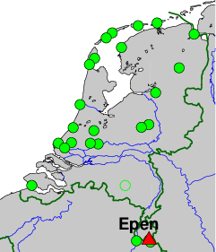
Integrated Geodetic Reference Station (IGRS), KNMI Seismic Station Heimansgroeve, Epen
On-site contact: Reinoud Sleeman, KNMI
GNSS contact: Hans van der Marel, TUD/GRS
GNSS Instrument(s)
| Name | Marker | Receiver | Antenna | Operator | Network | Start date | End date |
|---|
| epen | 13545M001 | SEPT POLARX5 | SEPCHOKE_B3E6 | TUD/CITG/GRS | IGRS | 2022-06-24 | |
Markers
| ID | Name | dX | dY | dZ | Instruments | Installed | Removed |
|---|
| 13545M001 | TOP OF IGRS MAST | 0.0000 | 0.0000 | 0.0000 | epen | 2022-06-21T12:00Z | |
Pictures
Active instruments
Marker ID: 13545M001
Operator: TUD/CITG/GRS
Log file:
epen00nld_20260116.log
Receiver
| Installed | week/d doy | Removed | week/d doy | Receiver type | S/N | Firmware |
|---|
| 2022-06-24T00:00Z | 2215/5 175 | 2023-04-17T06:56Z | 2258/1 107 | SEPT POLARX5 | 3080070 | 5.4.0 |
| 2023-04-17T06:56Z | 2258/1 107 | | | SEPT POLARX5 | 3080070 | 5.5.0 |
Antenna
| Installed | week/d doy | Removed | week/d doy | Antenna type | Dome | S/N | Height | Antenna calibration |
|---|
| 2022-06-24T00:00Z | 2215/5 175 | | | SEPCHOKE_B3E6 | SPKE | 5887 | 0.0000 | |
External Frequency
| Installed | week/d doy | Removed | week/d doy | Ext. Frequency type |
|---|
| 2022-06-24T00:00Z | 2215/5 175 | | | INTERNAL |
Notes
- 2022-06-24T00:00Z 2215/5 175 -
- The GNSS instrument mechanically connected to two 90 cm trihedral corner reflectors for
co-locating (In)SAR ascending and descending radar observations. The GNSS monument
itself consists of a SECO mount, on top of a 3.5 m heigh 8 cm diameter stainless steel
pipe, with a 35 cm square strudded footplate. On each side, a 90 cm corner reflector for
ascending and descending InSAR tracks is attached to the pole. A GCP for LIDAR measurements
(the top plate of the IGRS) is present. The whole assembly
is mounted on a concrete bunker on top of carboon bedrock. The bunker is 1 meter below the ground
and 7 meter high. The top plate of the IGRS (CGP for Lidar) is 2.1 meter above the concrete bunker
and xx meter above the ground. The GNSS antenna is xx m above the ground
For more information contact Hans van der Marel.