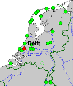
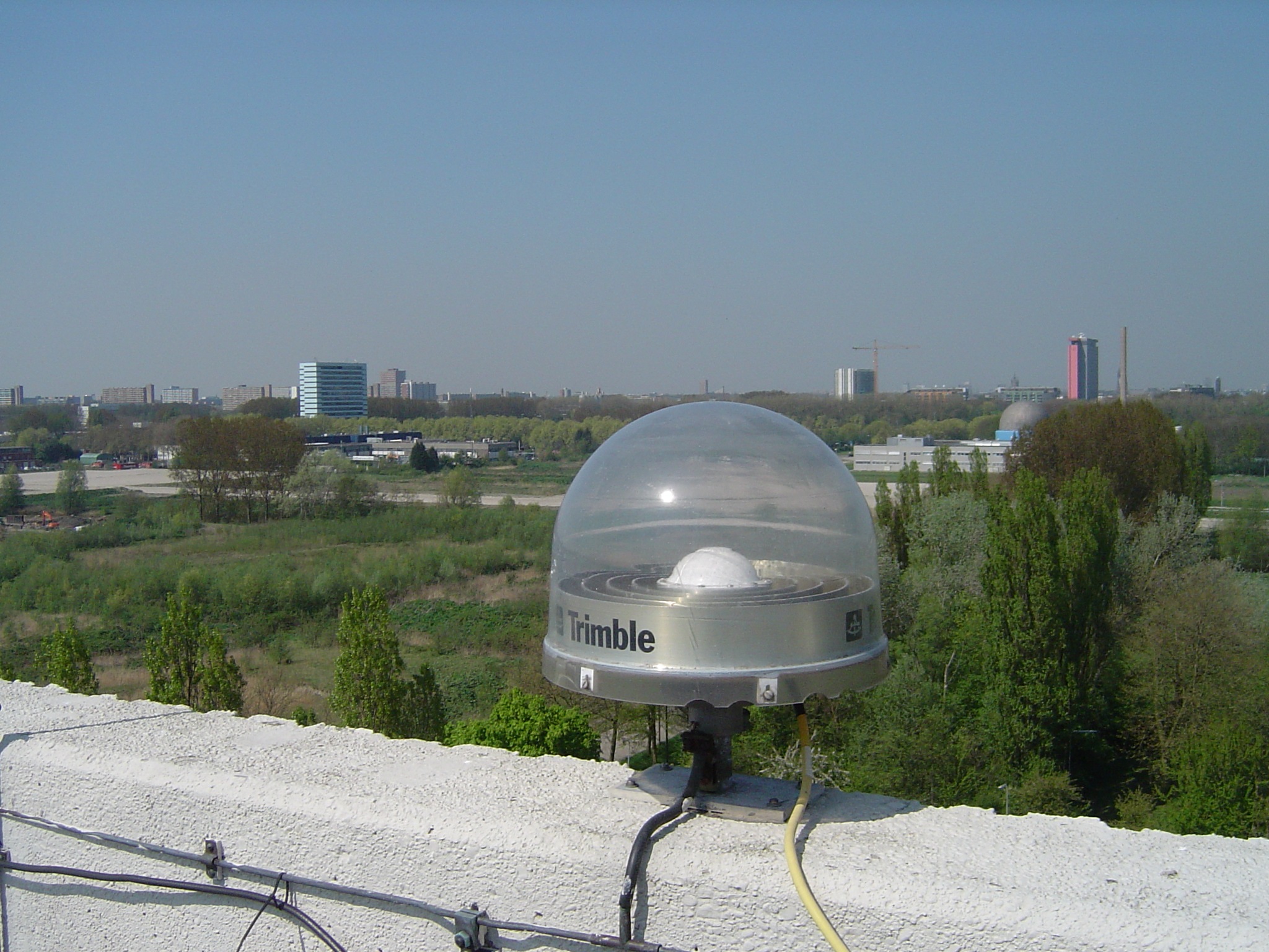
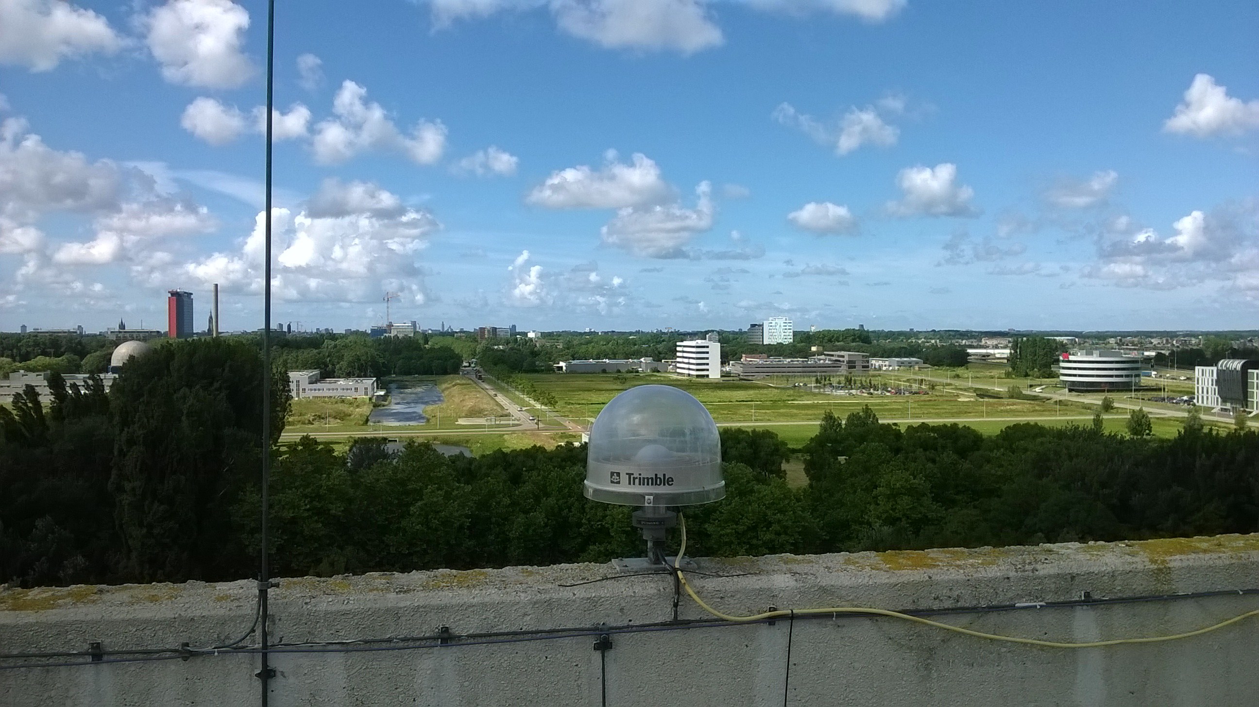
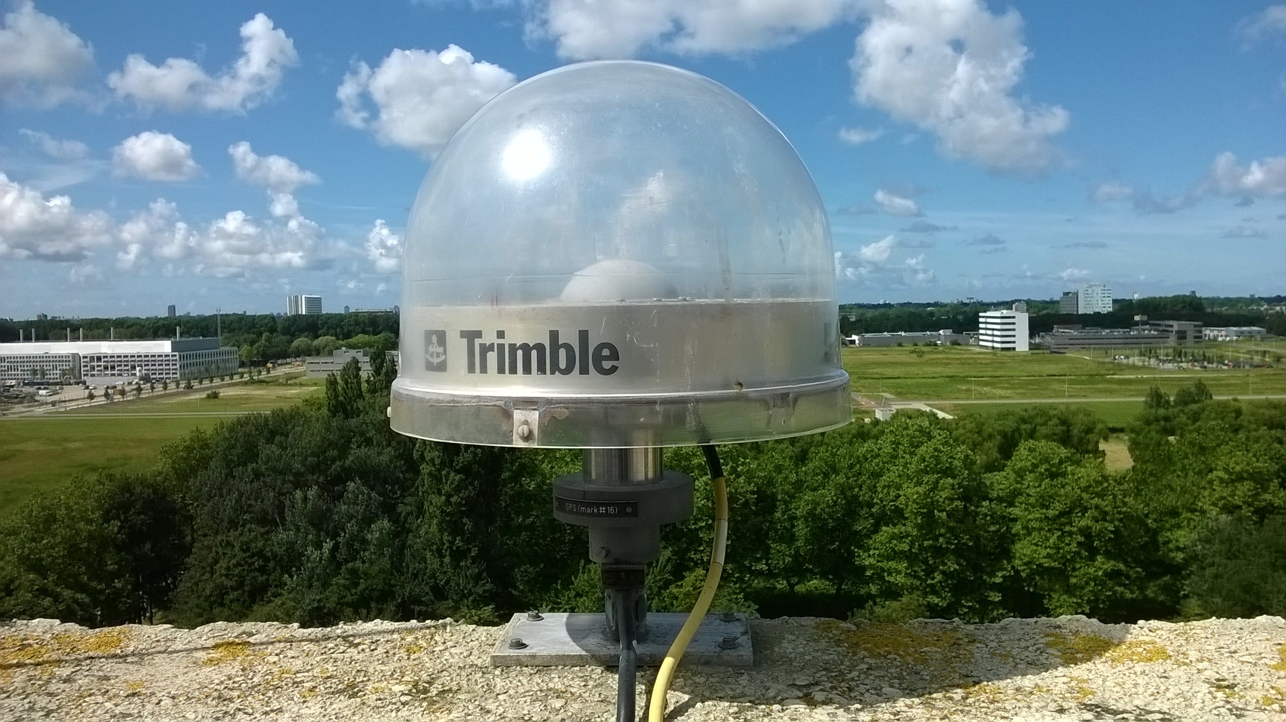
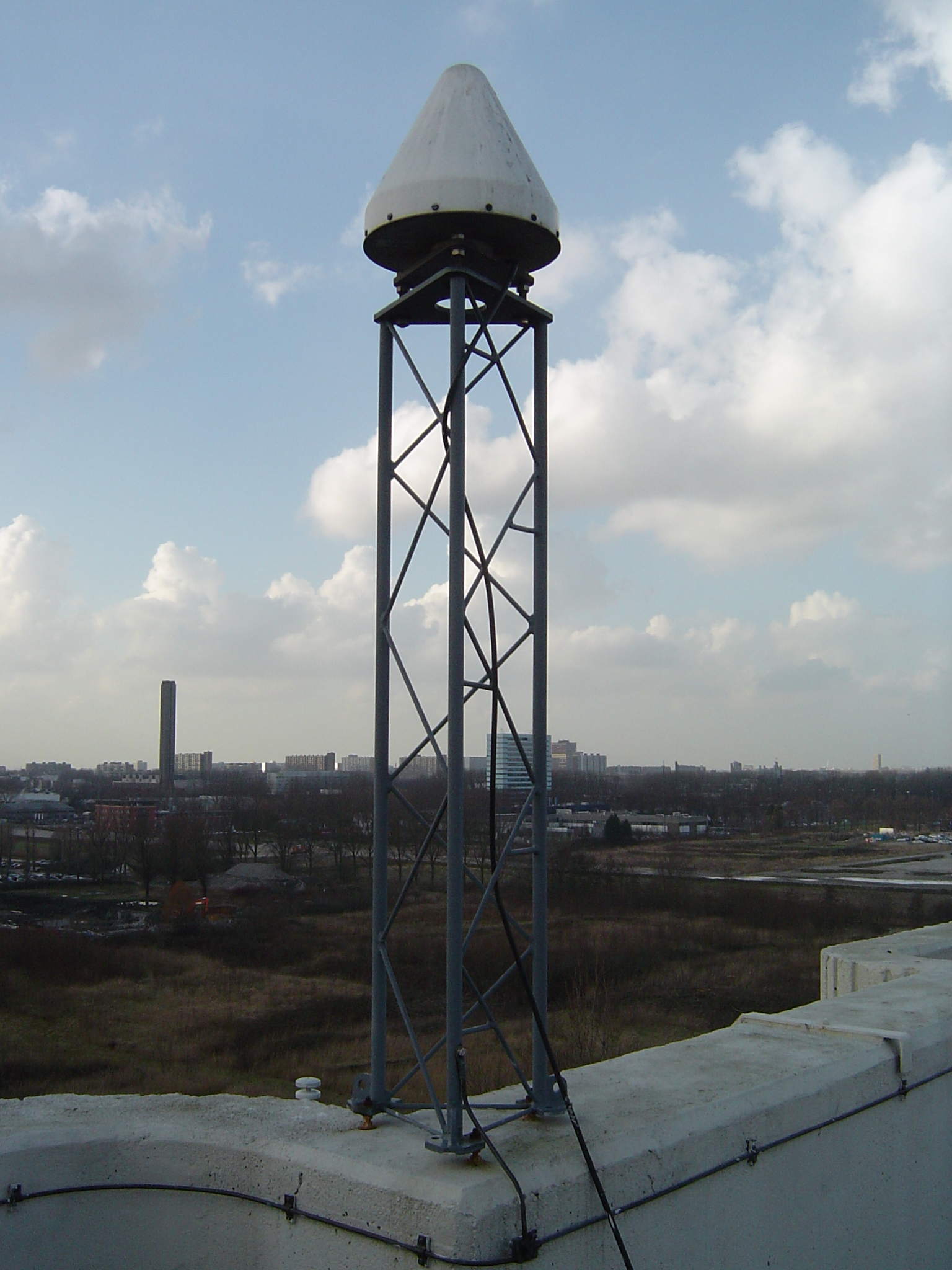
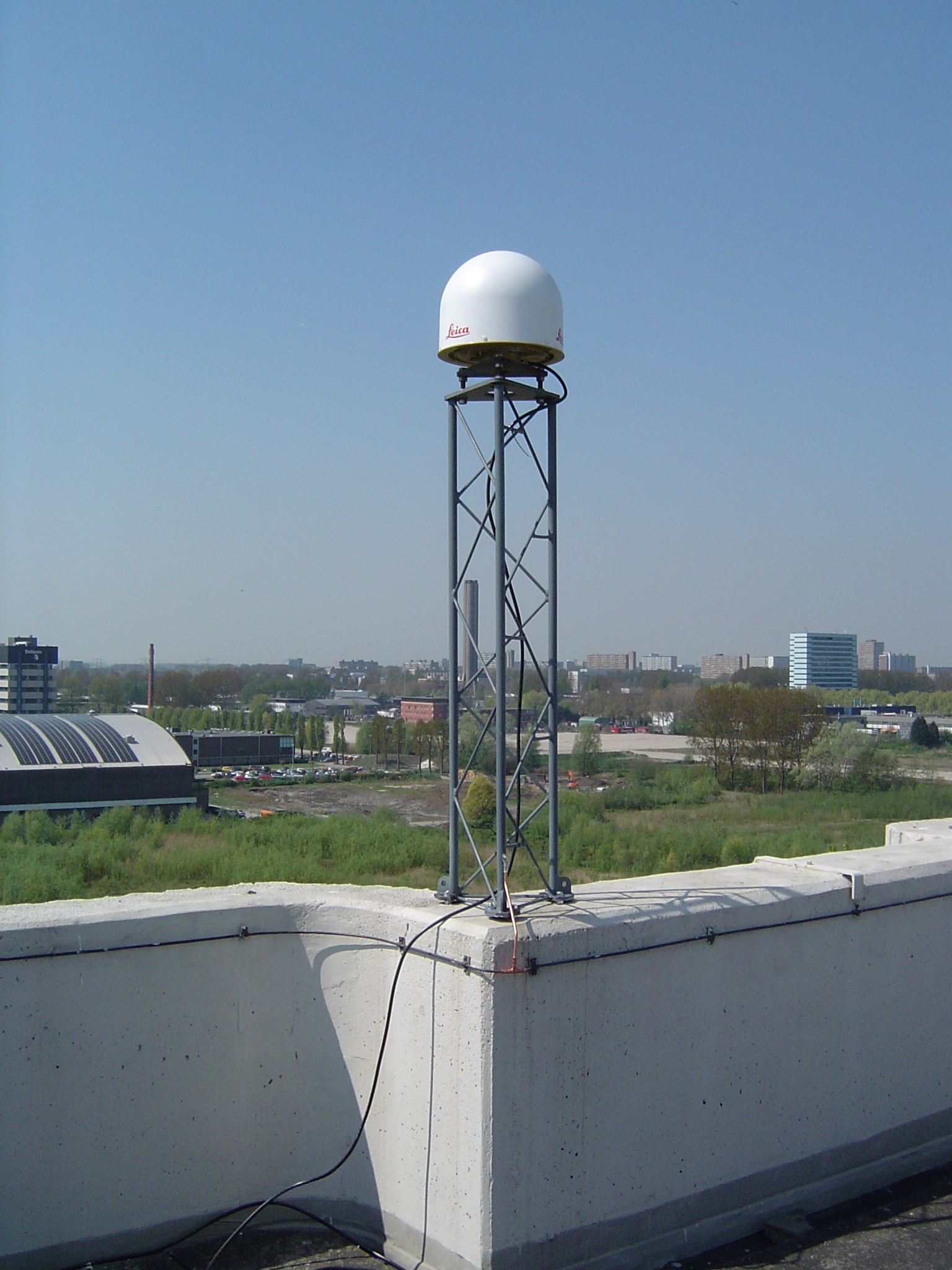
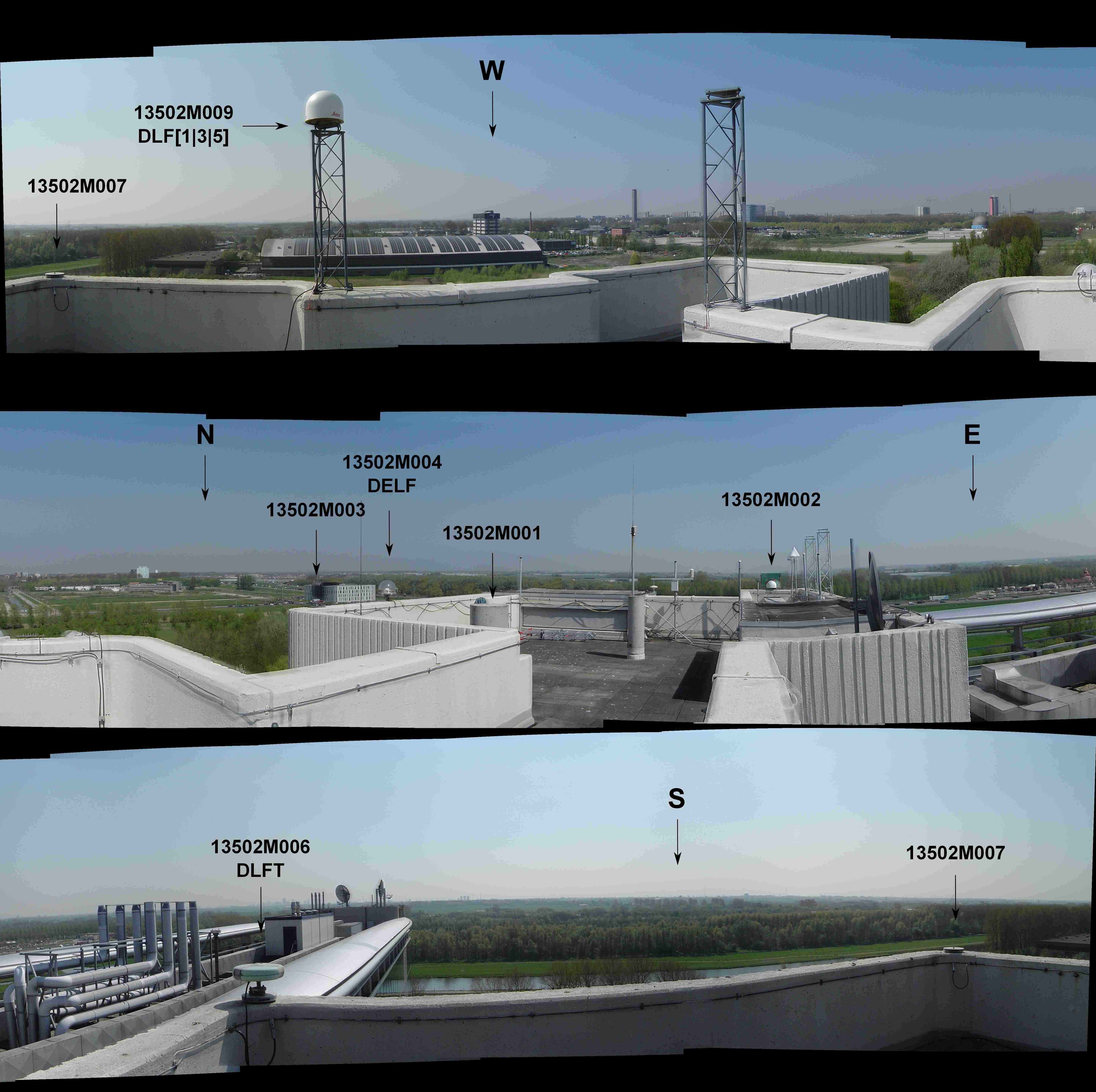
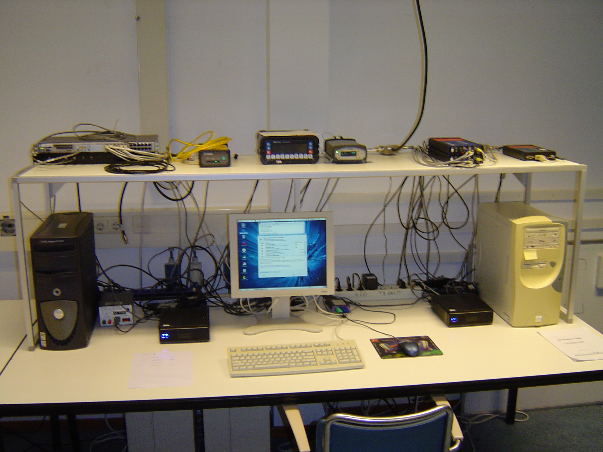
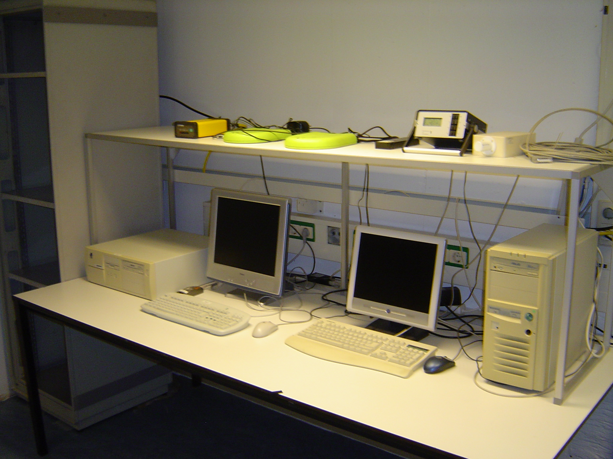
GNSS Laboratory of the Delft University of Technology, Department Geoscience and
Remote Sensing, on the former Geodesy building, Thijsseweg 11, 2629 JA Delft,
The Netherlands.
On-site contact: Hans van der Marel, TUD/CITG/GRS
GNSS Instrument(s)
| Name | Marker | Receiver | Antenna | Operator | Network | Start date | End date |
|---|
| delf | 13502M004 | SEPT POLARX5E | SEPCHOKE_B3E6 | TUD/CITG/GRS,NSGI | EPN,AGRS.NL | 1994-12-30 | |
| dlft | 13502M006 | JPS LEGACY | JPSREGANT_DD_E | TUD/CITG/GRS | IGS | 1998-08-17 | 2012-02-14 |
| dlf1 | 13502M009 | TRIMBLE ALLOY | LEIAR25.R3 | TUD/CITG/GRS | IGS | 2011-04-15 | |
| dlf2 | 13502M009 | JAVAD TRE_G3TH DELTA | LEIAR25.R3 | TUD/CITG/GRS,JAXA | JAXA | 2012-04-06 | 2017-12-14 |
| dlf3 | 13502M009 | JAVAD TRE_G3TH DELTA | LEIAR25.R3 | TUD/CITG/GRS,JPL | GDGPS | 2002-09-04 | 2019-03-25 |
| dlf4 | 13502M007 | SEPT POLARX2 | LEIAT504 | TUD/CITG/GRS | EDCN | 2001-11-15 | 2010-12-05 |
| dlf5 | 13502M009 | SEPT POLARX2 | LEIAR25.R3 | TUD/CITG/GRS | EDCN | 2004-06-18 | 2019-02-16 |
| dlf5x | 13502M007 | SEPT POLARX2 | LEIAR25.R3 | TUD/CITG/GRS | EDCN | 2004-06-18 | 2011-02-22 |
| dlf9 | 13502M007 | TRIMBLE NETR9 | LEIAR25.R3 | TUD/CITG/GRS | NONE | 2011-02-22 | 2011-04-15 |
| vslf | 31 | SEPT POLARX4TR | TPSCR.G3 | VSL | NONE | 2012-06-04 | |
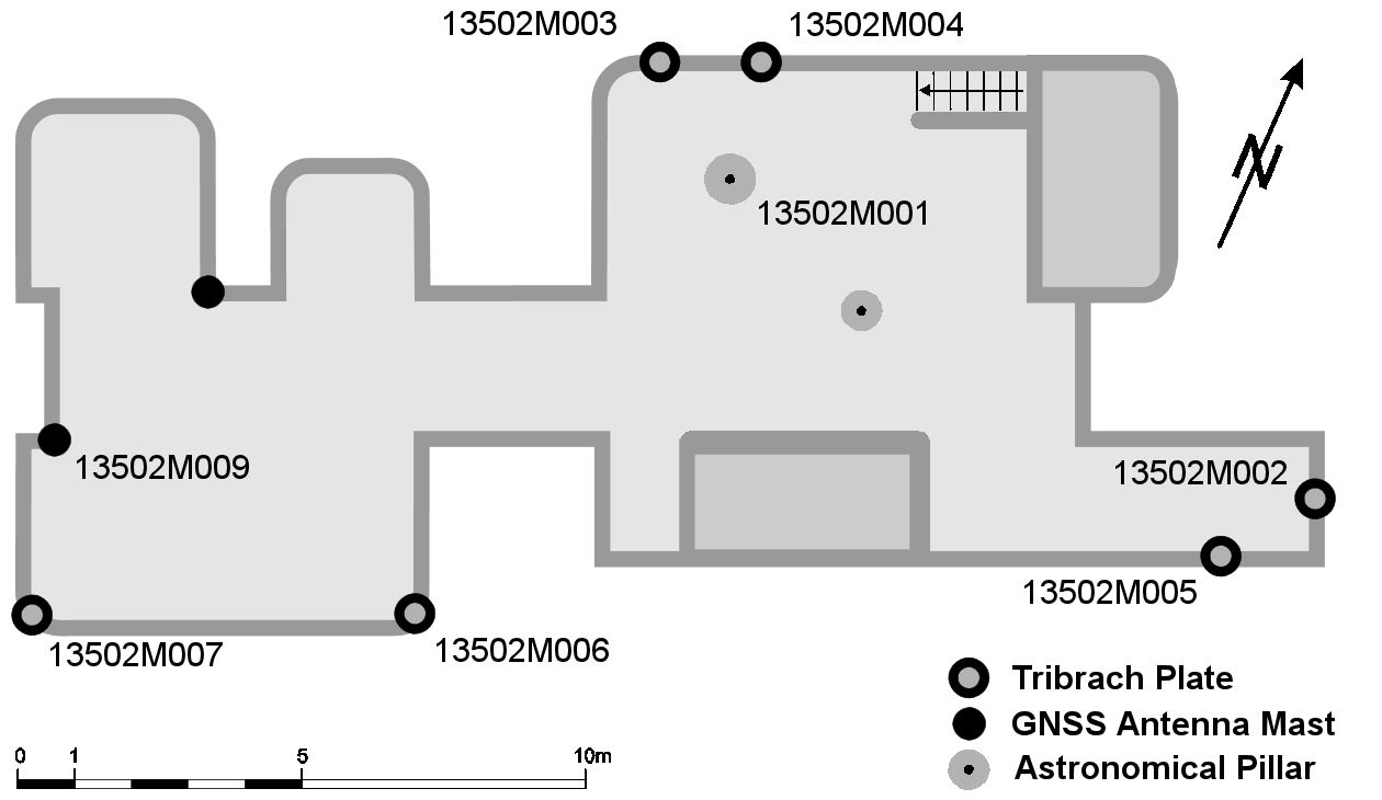
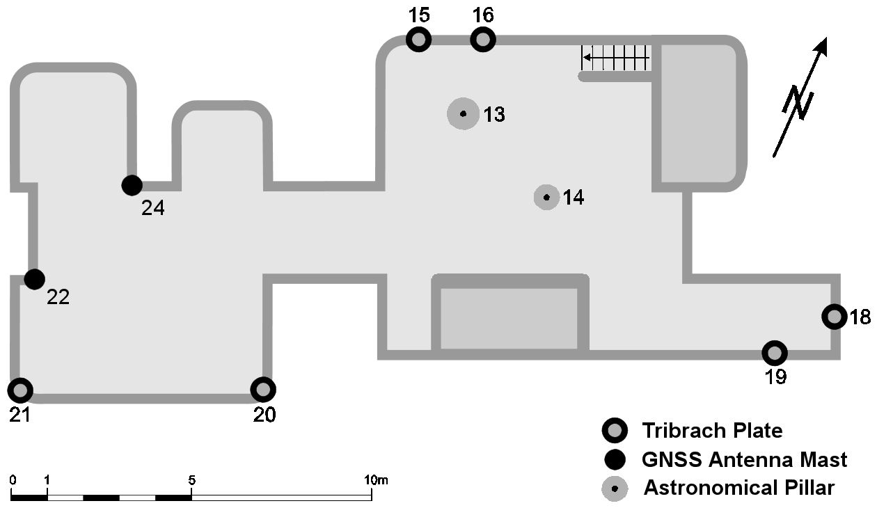
Markers
| ID | Name | dX | dY | dZ | Instruments | Installed | Removed |
|---|
| 13502M001 | BIG ASTRON. PILLAR | 0.0000 | 0.0000 | 0.0000 | | | |
| 13502M002 | GPS EUREF 89 (MARK # 18) | -0.2220 | 11.6050 | -0.5370 | | | |
| 13502M003 | GPS MARK # 15 | -1.0110 | -2.7060 | 1.0600 | | | |
| 13502M004 | GPS MARK # 16 | -1.8180 | -0.9580 | 1.5840 | delf | | |
| 13502M005 | GPS MARK # 19 | 1.5260 | 9.5330 | -1.7740 | | | |
| 13502M006 | GPS MARK # 20 | 7.6730 | -1.8940 | -5.8960 | dlft | | |
| 13502M007 | GPS MARK # 21 | 10.1900 | -8.0380 | -7.4890 | dlf4,dlf5x,dlf9 | | |
| 13502M009X | GPS MARK # 02 (AKA # 22) | 8.5715 | -8.9207 | -4.1662 | | | 2011-04-15T10:00Z |
| 13502M009 | GPS MARK # 02 (AKA # 22) | 8.5932 | -8.9176 | -4.1913 | dlf1,dlf2,dlf3,dlf5 | 2011-04-15T10:00Z | |
| 13502M010 | GPS MARK # 04 (AKA # 23) | 4.2855 | 5.3092 | -1.6755 | | | 2004-10-01T09:00Z |
| 31 | GPS MARK # 31 | -99.999 | -99.999 | -99.999 | vslf | | |
Meteo sensors
| Installed | week/d doy | Removed | week/d doy | Pressure | Temperature | Humidty |
|---|
| 1994-04-19T00:00Z | 0745/2 109 | 2006-05-03T00:00Z | 1373/3 123 | VAISALA PTB200A | VAISALA HMP233 | VAISALA HMP233 |
Pictures
Notes
- 1997-03-25T00:00Z 0898/2 084 -
- Cell phone antenna were installed on the South tower, 100 meters from the GNSS
antennae, transmitting in a 240 degrees sector.
The GNSS antennae are located in a 120 degrees sector not covered by the
cell phone (GSM) system. Test with a receiver at 5 meters from the GSM antenna
have shown no degradation of the GPS, so it is very unlikely that the GPS
observations of the North tower are affected and we have so-far observed
no degradation at all.
- 2003-09-01T00:00Z 1234/1 244 - 2005-01-31T00:00Z 1308/1 031
- The department of Geodesy moved to Aerospace Eng. The former Geodesy building
has been sold to the Dutch Metrology Institute (NMI) who will move into the
building January 2005. Until then the building is empty and is undergoing
reconstruction.
A deal was made with the new owner to continue the GPS observations during and after
the reconstruction.
Over the next months all technical installations, inventory, cabling, piping
and internal walls were removed, resulting in a completely empty and bare
building w/o water, heating and electricity.
The observatory switched to a temporary power supply and a dedicated Internet
connection.
Access to the premises restricted working days from 8.00 to 16.00 local time.
After Oct 2003 a gradual change southwards of about 1 cm in total on Feb 2004,
starting Mar 2004 the movement reversed in the North direction.
Over Jan/Feb 2004 a 3-4 mm movement in East-West direction, stable again after
Feb 2004.
Signs of increased scatter in East-West direction since Apr 2004.
- 2004-04-13T00:00Z 1266/2 104 -
- The stairs to the observation platform have been removed and a temporary roof
was installed over the former stairs (now a vertical shaft).
- 2004-05-10T02:12Z 1270/1 131 -
- Antenna cable of Trimble 4700 disconnected by vandals resulting in a loss of
several hours of data. No other dammage or stolen items from the observatory.
Receiver tracking after the event became very poor, which was noticed because
we lost the internet connection next day. Receiver tracking became
again nominal after the change over from Saterday/Sunday 15/16 May.
- 2004-05-11T06:30Z 1270/2 132 - 2004-05-14T12:00Z 1270/5 135
- The Internet glasfibre cable outside the building was hit by a pile and Internet
connection was lost. Repairs were effectuated and the Internet connection was
restored on May 14th.
- 2004-05-29T06:10Z 1272/6 150 - 2004-06-01T08:04Z 1273/2 153
- Power failure. This Saterday morning vandals tried to steal coper cables, and
nearly electrocuted themselves. Suspects were arrested several weeks
after this event.
Power restored again on Monday morning.
- 2004-06-24T14:00Z 1276/4 176 - 2004-07-06T08:00Z 1278/2 188
- During a storm the temporary roof installed on April 13 was blown away, partly
blocking low elevation signals to the South. Two antenna cables were damaged,
but no other damages.
The contractor promissed to clean-up and restore the roof a.s.a.p., but actually
nothing happened until 5 or 6 July when the former roof was moved a little
reducing the effects of the blockage somewhat.
- 2004-06-24T14:00Z 1276/4 176 - 2004-12-15T09:00Z 1301/3 350
- A temporary construction lift was attached to the North tower on 2004 Jun 24-30
(date not known exactly), where all the antenna are.
The lift is on the North side and connected firmly to the
building. About 75 cm of the metal tower is above the concrete balustrade,
about 4 meters to the West from the Trimble 4700 antenna.
On June 30 we noticed a change in the amount of data that is tracked.
The temporary lift was removed somewhere in the beginning of December 2004
(date not known exactly).
- 2011-04-15T10:00Z 1631/5 105 -
- Marker 13502M009 had to be temporarily removed and was reinstalled later
at more or less the same position. This resulted in a move of 32.7 mm to
the South, 1.4 mm to the East and 6.3 mm Down. The shift is: dX=0.0217,
dY=0.0031, dZ=-0.0251 in ECEF, or dN=-0.0327, dE=0.0014, dU= -0.0063 in
a local frame. The old marker has been renamed to 13502M009X.
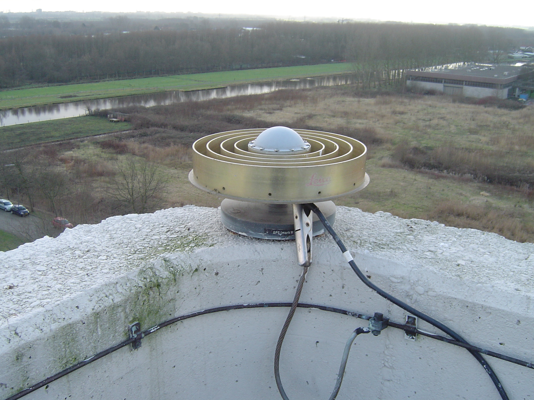
At the same time the Ahstech Chokering antenna was replaced by a LEICA AR25.R3
chokering.
The antenna cable run consists of a 30 m LMR400 outdoors, a Huber-Suhner type
3402.17.A surge protector, 10 m LMR400 indoors, GPS Networking Inc. 4-way
high-isolation antenna splitter N HI AL DCB S1X4-N/ 12/ 220, with 17 dB gain
and 12 V DC feed to the antenna, and short 3 m cables to the each receiver.
- 2011-04-15T10:00Z 1631/5 105 -
- The antenne for the Eurocontrol Data Collection Network (EDCN) has been
moved from marker 13502M007 to marker 13502M009.
- 2013-11-01T13:05Z 1764/5 305 -
- The antenna splitter connecting the LEIAR25.R3 LEIT (marker 13502M009) to DLF1, DLF2, DLF3 and DLF5 has been
replaced on November 1, 2013, between 13:50-13:10 UTC. The new splitter is a Networked High Isolated
Amplified DC Blocked 1x8 splitter from GPS Networking (NHIALDCBS1X8-T/12/220, S/N 76256). It replaces
a 1x4 splitter from the same brand (NHIALDCBS1X4-N/12/220, S/N 53494).
The antenna cable run now consists of a 30 m LMR400 outdoors, a Huber-Suhner type
3402.17.A surge protector, 10 m LMR400 indoors, GPS Networking Inc. 8-way
high-isolation antenna splitter N HI AL DCB S1X8-T/ 12/ 220, with 14 dB gain
and 12 V DC feed to the antenna, and 3 m flexible RG223 type cables from the splitter
to the each receiver.
- 2015-08-03T18:15Z 1856/1 215 - 2015-08-04T11:40Z 1856/2 216
- The antenna cable of the LEIAR25.R3 LEIT antenna on marker 13502M009 has been replaced (DLF1, DLF2, DLF3 and DLF5).
In order to change the antenna cable the antenna had to be unbolted from the monument; after the cable replacement
the same antenna was reattached to the monument in exactly the same position. The bronze alloy retaining bolt has
been replaced by a stainless steel bolt. The new antenna cable is of the same type LMR400 and length. The antenna
was in good working order and was cleaned. The antenna was operational again on Aug 4 2015, 11:39:28 UTC.
No data is available from Aug 3 2015, 18:15:21 until Aug 4 2015, 11:39:28 UTC.
- 2019-07-28T02:54Z 2064/0 209 - 2019-08-05T14:00Z 2065/1 217
- The antenna cable of the LEIAR25.R3 LEIT antenna had developed a fault Sunday 28 July around 02:54 UTC resulting in a total loss
of data for all connected receivers (DLF100NLD, DLF500NLD , DLF600NLD, DLF700NLD, DLF800NLD, DLF900NLD and DLFV00NLD).
On 5 August, 13:30 UTC, the antenna was temporarily removed, and an inspection revealed that the connector had developed a fault,
but that the antenna itself was ok. The antenna cable shortened by 2 meters and a new connector was installed. The antenna and
serial number are the same as was used before.
The antenna and connected receivers were operational again on August 5, 2019, around 14:00 UTC.
Active instruments
Marker ID: 13502M004
Operator: AGRS.NL (KAD,MD,TUD)
Log file:
delf00nld_20230630.log
Receiver
| Installed | week/d doy | Removed | week/d doy | Receiver type | S/N | Firmware |
|---|
| 1994-12-30T13:00Z | 0781/5 364 | 1995-12-26T23:59Z | 0833/2 360 | ROGUE SNR-8000 | 175 | 3.2.32.1 |
| 1995-12-27T17:22Z | 0833/3 361 | 1997-11-20T16:50Z | 0932/4 324 | ROGUE SNR-12 RM | 222 | 3.2.32.1 |
| 1997-11-20T17:06Z | 0932/4 324 | 1999-07-08T14:30Z | 1017/4 189 | ROGUE SNR-12 RM | 211 | 3.2.32.1 |
| 1999-07-08T15:15Z | 1017/4 189 | 2000-07-23T06:30Z | 1072/0 205 | ROGUE SNR-12 RM | 211 | 3.2.32.9 |
| 2000-07-23T07:00Z | 1072/0 205 | 2002-11-18T07:00Z | 1193/1 322 | TRIMBLE 4700 | 96517 | 1.20 |
| 2002-11-18T10:30Z | 1193/1 322 | 2015-11-27T00:00Z | 1872/5 331 | TRIMBLE 4700 | 96517 | N1.30/S0.00 |
| 2015-11-27T17:00Z | 1872/5 331 | 2019-03-29T10:16Z | 2046/5 088 | TPS ODYSSEY_E | 323-0386 | 3.5 Mar,16,2011 p1 |
| 2019-03-29T10:17Z | 2046/5 088 | 2022-02-24T10:55Z | 2198/4 055 | TPS ODYSSEY_E | 323-0386 | 3.5 Feb,01,2019 p5 |
| 2022-02-24T12:00Z | 2198/4 055 | 2023-06-30T09:25Z | 2268/5 181 | SEPT POLARX5E | 3048221 | 5.4.0 |
| 2023-06-30T09:25Z | 2268/5 181 | | | SEPT POLARX5E | 3048221 | 5.5.0 |
Antenna
| Installed | week/d doy | Removed | week/d doy | Antenna type | Dome | S/N | Height | Antenna calibration |
|---|
| 1994-12-30T13:00Z | 0781/5 364 | 1996-03-08T14:59Z | 0843/5 068 | AOAD/M_T | NONE | 177 | 0.000 | AOAD-M_T_RFI____NONE_177.atx |
| 1996-03-08T15:00Z | 0843/5 068 | 1996-07-25T09:49Z | 0863/4 207 | AOAD/M_T | NONE | 246 | 0.000 | |
| 1996-07-25T09:50Z | 0863/4 207 | 1996-07-30T11:14Z | 0864/2 212 | AOAD/M_T | NONE | 243 | 0.000 | |
| 1996-07-30T11:15Z | 0864/2 212 | 1996-08-08T13:29Z | 0865/4 221 | AOAD/M_T | NONE | 177 | 0.000 | AOAD-M_T_RFI____NONE_177.atx |
| 1996-08-08T13:30Z | 0865/4 221 | 2000-07-23T06:30Z | 1072/0 205 | AOAD/M_T | DUTD | 240 | 0.000 | |
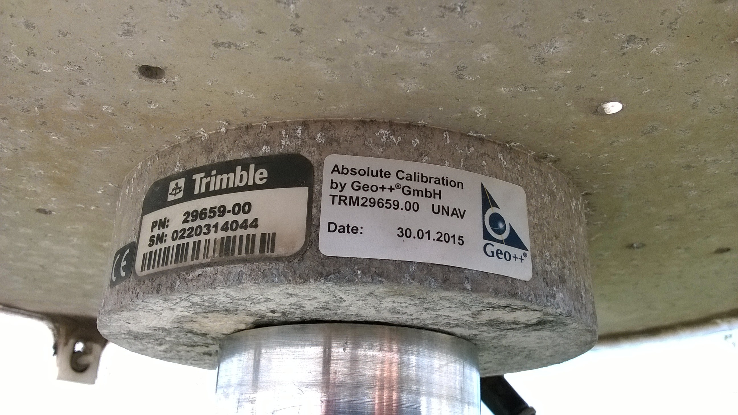
| 2000-07-23T07:00Z | 1072/0 205 | 2016-07-13T13:30Z | 1905/3 195 | TRM29659.00 | UNAV | 93258 | 0.000 | |
| 2016-07-13T13:30Z | 1905/3 195 | 2022-02-24T11:00Z | 2198/4 055 | TRM29659.00 | UNAV | 0220314044 | 0.050 | TRM29659.00_____UNAV_0220314044.atx |
| 2022-02-24T12:00Z | 2198/4 055 | | | SEPCHOKE_B3E6 | SPKE | 5741 | 0.000 | SEPCHOKE_B3E6___SPKE_5741.atx |
External Frequency
| Installed | week/d doy | Removed | week/d doy | Ext. Frequency type |
|---|
| 1994-12-30T00:00Z | 0781/5 364 | | | INTERNAL |
Notes
- 2016-07-13T13:30Z 1905/3 195 - 2022-02-24T11:00Z 2198/4 055
- A 50 mm spacer was inserted between the antenna and marker, flush with inner ring in BPA. BPA
has been seriously corroded due to salt-water conditions in previous installation.
- 2019-12-04T00:00Z 2082/3 338 - 2020-06-24T00:00Z 2111/3 176
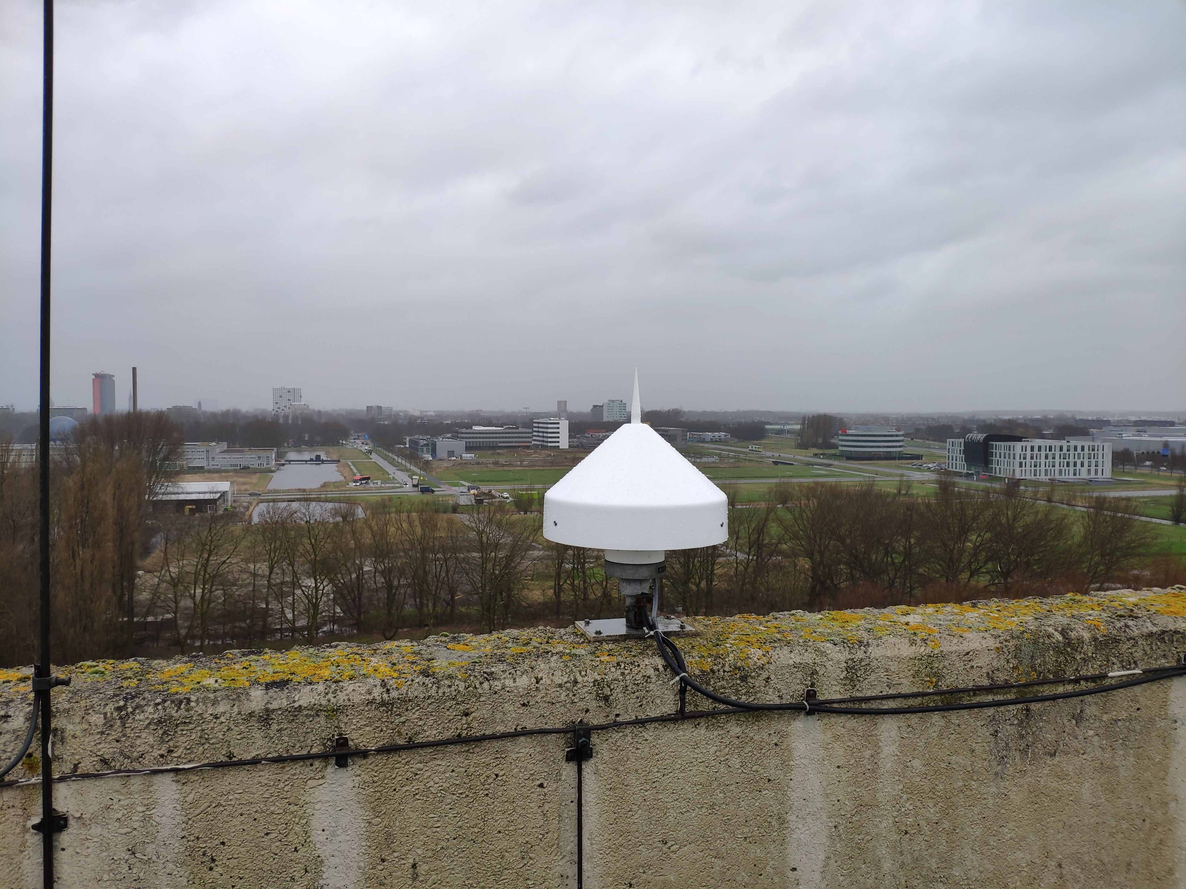
- The radome on the TRM29659.00 was lost sometime in the preriod between December 2019 and June 2020.
The exact date is not known. The antenna designation was not changed because (i) the effect of the radome
on the calibration appears to be very small, (ii) the change in antenna type calibration would introduce
another step in the time series, and (iii) the exact date is not known.
- 2022-02-24T12:00Z 2198/4 055 -
- The antenna cable on the roof was replaced by 15 meter PRO PUR coaxkabel Low loss N-m to N-m (RG214), from the antenna to the HUBER-SUHNER 34U2.17A
protector. The 8 m cable inside the building between the protector and receiver was not changed.
Marker ID: 13502M009
Operator: DELFT UNIVERSITY OF TECHNOLOGY
Log file:
dlf100nld_20230424.log
Receiver
| Installed | week/d doy | Removed | week/d doy | Receiver type | S/N | Firmware |
|---|
| 2011-04-15T10:00Z | 1631/5 105 | 2011-06-22T11:20Z | 1641/3 173 | TRIMBLE NETR9 | 5039K70764 | 4.22 |
| 2011-06-22T11:20Z | 1641/3 173 | 2012-02-01T12:32Z | 1673/3 032 | TRIMBLE NETR9 | 5039K70764 | 4.42 |
| 2012-02-01T12:32Z | 1673/3 032 | 2012-05-03T11:30Z | 1686/4 124 | TRIMBLE NETR9 | 5039K70764 | 4.43 |
| 2012-05-03T11:30Z | 1686/4 124 | 2012-05-08T11:05Z | 1687/2 129 | TRIMBLE NETR9 | 5039K70764 | 4.46 |
| 2012-05-08T11:05Z | 1687/2 129 | 2013-02-18T22:15Z | 1728/1 049 | TRIMBLE NETR9 | 5039K70764 | 4.60 |
| 2013-02-18T22:15Z | 1728/1 049 | 2013-05-09T06:05Z | 1739/4 129 | TRIMBLE NETR9 | 5039K70764 | 4.70 |
| 2013-05-09T06:05Z | 1739/4 129 | 2013-08-12T14:15Z | 1753/1 224 | TRIMBLE NETR9 | 5039K70764 | 4.80 |
| 2013-08-12T14:15Z | 1753/1 224 | 2015-06-18T21:30Z | 1849/4 169 | TRIMBLE NETR9 | 5039K70764 | 4.81 |
| 2015-06-18T21:30Z | 1849/4 169 | 2015-07-13T17:10Z | 1853/1 194 | TRIMBLE NETR9 | 5039K70764 | 5.01 |
| 2015-07-13T17:10Z | 1853/1 194 | 2016-07-20T16:15Z | 1906/3 202 | TRIMBLE NETR9 | 5039K70764 | 5.03 |
| 2016-07-20T16:15Z | 1906/3 202 | 2016-12-21T18:43Z | 1928/3 356 | TRIMBLE NETR9 | 5039K70764 | 5.14 |
| 2016-12-21T18:43Z | 1928/3 356 | 2017-05-28T09:12Z | 1951/0 148 | TRIMBLE NETR9 | 5039K70764 | 5.15 |
| 2017-05-28T09:12Z | 1951/0 148 | 2018-10-29T14:02Z | 2025/1 302 | TRIMBLE NETR9 | 5039K70764 | 5.22 |
| 2018-10-29T14:03Z | 2025/1 302 | 2019-10-26T15:23Z | 2076/6 299 | TRIMBLE NETR9 | 5039K70764 | 5.37 |
| 2019-10-26T15:23Z | 2076/6 299 | 2020-05-16T15:15Z | 2105/6 137 | TRIMBLE NETR9 | 5039K70764 | 5.43 |
| 2020-05-16T15:15Z | 2105/6 137 | 2023-04-24T12:15Z | 2259/1 114 | TRIMBLE NETR9 | 5039K70764 | 5.45 |
| 2023-04-24T12:15Z | 2259/1 114 | | | TRIMBLE ALLOY | 6235R40294 | 6.20 |
Antenna
| Installed | week/d doy | Removed | week/d doy | Antenna type | Dome | S/N | Height | Antenna calibration |
|---|
| 2011-04-15T10:00Z | 1631/5 105 | | | LEIAR25.R3 | LEIT | 10030006 | 0.0000 | LEIAR25.R3______LEIT_10030006.atx |
External Frequency
| Installed | week/d doy | Removed | week/d doy | Ext. Frequency type |
|---|
| 2011-04-15T10:00Z | 1631/5 105 | 2011-06-22T11:20Z | 1641/3 173 | INTERNAL |
| 2011-06-22T11:20Z | 1641/3 173 | | | EXTERNAL CESIUM + RX_CLOCK_STEERING_ON |
Notes
- 2019-07-28T02:54Z 2064/0 209 - 2019-08-05T14:00Z 2065/1 217
- The antenna cable of the LEIAR25.R3 LEIT antenna had developed a fault Sunday 28 July around 02:54 UTC resulting in a total loss
of data for all connected receivers (DLF100NLD, DLF500NLD , DLF600NLD, DLF700NLD, DLF800NLD, DLF900NLD and DLFV00NLD).
On 5 August, 13:30 UTC, the antenna was temporarily removed, and an inspection revealed that the connector had developed a fault,
but that the antenna itself was ok. The antenna cable shortened by 2 meters and a new connector was installed. The antenna and
serial number are the same as was used before.
The antenna and connected receivers were operational again on August 5, 2019, around 14:00 UTC.
- 2015-08-03T18:15Z 1856/1 215 - 2015-08-04T11:40Z 1856/2 216
- The antenna cable of the LEIAR25.R3 LEIT antenna (DLF1) has been replaced. In order to change the antenna cable the
antenna had to be detached from the monument; after the cable replacement the same antenna was reattached to the
monument in exactly the same position. The bronze alloy retaining bolt has been replaced by a stainless steel bolt.
The new antenna cable is of the same type LMR400 and length. The antenna was in good working order and was cleaned.
The antenna was operational again on Aug 4 2015, 11:39:28 UTC.
No data is available from Aug 3 2015, 18:15:21 until Aug 4 2015, 11:39:28 UTC.
- 2015-07-01T00:00Z 1851/3 182 -
- DLF1 has been added to the IGS and EPN networks. See IGS mail IGSSTATION-6225. At the same time DLF1 has been added
to the EPN network and routine uploads of RINEX 2 data to BKGI and OLG were started. RINEX 3 data continues to be
available from the IGS-MGEX data stores.
- 2015-03-01T00:00Z 1834/0 060 -
- In addition to daily, hourly and high-rate RINEX 3 for all systems, daily RINEX 2 with 30 sec GPS and GLONASS data are available
since the start op operation in April 2011. Since 1 March 2015 also hourly RINEX 2 files, with 10 second GPS and GLONASS, are kept.
- 2012-04-23T10:00Z 1685/1 114 - 2012-05-03T11:18Z 1686/4 124
- No data has been logged on account of a disk-full condition.
- 2012-02-01T15:00Z 1673/3 032 -
- DLF1 started streaming NTRIP data to Trimble VRS-NOW.
- 2011-11-04T14:01Z 1660/5 308 - 2012-02-01T13:00Z 1673/3 032
- All data for this period has been lost.
- 2011-06-22T11:20Z 1641/3 173 -
- Receiver was connected to the external CESIUM clock of the NMI. The 10 MHz from the external CESIUM was
enabled in the receiver settings from the start. However, clock steering has not been disabled
during this period, except fro some brief experimentation, and is currenty on. During some short periods in 2011
clock steering was disabled. So the receiver is running on the external frequency, but the clock is still
adjusted using satellite signals. Clock steering will be disabled on a later to be announced moment in 2015.
- 2011-04-15T10:00Z 1631/5 105 -
- All systems (GPS+GLO+GAL+BEI+QZSS+SBAS) are tracked and data is archived in daily 30 sec interval, hourly 10 sec
interval and 15 minute high-rate 1 Hz multi GNSS RINEX version 3 files, as well as the raw data in T02 format.
The GPS and GLONASS data is kept also as daily 30 second RINEX version 2 files for legacy purposes. Starting 1 March
2015 also hourly RINEX 2 files with 10 second GPS and GLONASS are saved.
- 2011-04-15T10:00Z 1631/5 105 -
- DLF1 is part of the IGS M-GEX network. DLF1 is also intended as a replacement for IGS station DLFT.
Marker ID: 31
Operator: VSL
Receiver
| Installed | week/d doy | Removed | week/d doy | Receiver type | S/N | Firmware |
|---|
| 2012-06-04T00:00Z | 1691/1 156 | | | SEPT POLARX4TR | 3001395 | 2.3.3 |
Antenna
| Installed | week/d doy | Removed | week/d doy | Antenna type | Dome | S/N | Height | Antenna calibration |
|---|
| 2012-06-04T00:00Z | 1691/1 156 | | | TPSCR.G3 | TPSH | 383-1235 | 0.0000 | |
External Frequency
| Installed | week/d doy | Removed | week/d doy | Ext. Frequency type |
|---|
| 2012-06-04T00:00Z | 1691/1 156 | | | EXTERNAL CESIUM |
Discontinued instruments
Marker ID: 13502M006
Operator: TU DELFT
Log file:
dlft_20121101.log
Receiver
| Installed | week/d doy | Removed | week/d doy | Receiver type | S/N | Firmware |
|---|
| 1998-08-17T00:00Z | 0971/1 229 | 1998-10-15T00:00Z | 0979/4 288 | ASHTECH GG24C | 00120 | GG00 |
| 1998-10-15T00:00Z | 0979/4 288 | 1999-02-17T00:00Z | 0997/3 048 | ASHTECH GG24C | 00163 | GG00 |
| 1999-02-17T00:00Z | 0997/3 048 | 1999-03-29T00:00Z | 1003/1 088 | JPS LEGACY | 00143 | 1.4 |
| 1999-03-29T00:00Z | 1003/1 088 | 1999-05-09T00:00Z | 1009/0 129 | JPS LEGACY | 00287 | 1.5 pl3 |
| 1999-05-09T00:00Z | 1009/0 129 | 1999-07-06T00:00Z | 1017/2 187 | JPS LEGACY | 00287 | 1.6 pl2 |
| 1999-07-06T00:00Z | 1017/2 187 | 1999-09-17T00:00Z | 1027/5 260 | JPS LEGACY | 00287 | 1.8 pl2 |
| 1999-09-17T00:00Z | 1027/5 260 | 2000-04-21T00:00Z | 1058/5 112 | JPS LEGACY | 00287 | 1.9 pl6 |
| 2000-04-21T00:00Z | 1058/5 112 | 2004-07-17T08:46Z | 1279/6 199 | JPS LEGACY | 00287 | 2.0 pl5 |
| 2004-07-17T13:00Z | 1279/6 199 | 2007-11-07T11:20Z | 1452/3 311 | JPS LEGACY | 00286 | 2.3 Apr,28,2004 p4 |
| 2007-11-07T12:00Z | 1452/3 311 | 2008-03-11T10:00Z | 1470/2 071 | JPS LEGACY | 00286 | 2.6.0 Oct,24,2007 ob |
| 2008-03-11T10:30Z | 1470/2 071 | 2012-02-14T23:53Z | 1675/2 045 | JPS LEGACY | 00286 | 2.6.1 Jan,10,2008 |
Antenna
| Installed | week/d doy | Removed | week/d doy | Antenna type | Dome | S/N | Height | Antenna calibration |
|---|
| 1998-08-17T00:00Z | 0971/1 229 | 1999-02-17T00:00Z | 0997/3 048 | ASH700699.L1 | NONE | 13789 | 0.1018 | |
| 1999-02-17T00:00Z | 0997/3 048 | 1999-03-29T00:00Z | 1003/1 088 | JPSREGANT_SD_E | NONE | 00043 | 0.1000 | |
| 1999-03-29T00:00Z | 1003/1 088 | 2014-04-16T10:00Z | 1788/3 106 | JPSREGANT_DD_E | NONE | 00077 | 0.1000 | JPSREGANT_DD_ET_NONE_ra0077.atx |
External Frequency
| Installed | week/d doy | Removed | week/d doy | Ext. Frequency type |
|---|
| 1998-08-17T00:00Z | 0971/1 229 | 2004-07-22T00:00Z | 1280/4 204 | INTERNAL |
| 2004-07-22T00:00Z | 1280/4 204 | 2007-11-07T12:00Z | 1452/3 311 | EXTERNAL OCX |
| 2008-07-01T14:00Z | 1486/2 183 | 2012-02-14T23:53Z | 1675/2 045 | EXTERNAL CESIUM |
Notes
- 2012-02-14T23:53Z 1675/2 045 -
- The receiver/antenna developed a problem and no data has been recorded since 2012-02-15. The station DLFT was discommissioned
on 2012-04-16. The antenna will be removed for calibration. Users are adviced to use instead the IGS MGEX station DLF1 on the nearby
marker 13502M009.
- 2011-04-15T10:00Z 1631/5 105 -
- DLFT will be decommissioned in near future and replaced by DLF1 on
marker 13502M009. Data for DLFT will be available in parallel to DLF1
for a limited period. Please use DLF1 instead of DLFT. DLF1 provides
a multiple system (GPS/GLONASS/GALILEO) and frequency (L1/L2/L5)
receiver at a lower multipath location.
- 2004-03-08T15:00Z 1261/1 068 -
- Replaced antenna cable (Belden RG8) by LMR-400.
Marker ID: 13502M009
Operator: TUD/CITG/GRS,JAXA
Receiver
| Installed | week/d doy | Removed | week/d doy | Receiver type | S/N | Firmware |
|---|
| 2012-04-06T14:00Z | 1682/5 097 | 2012-12-28T13:30Z | 1720/5 363 | JAVAD TRE_G3TH DELTA | 00733 | 3.5.0a0 Feb,01,2012 |
| 2012-12-28T13:30Z | 1720/5 363 | 2013-05-15T12:00Z | 1740/3 135 | JAVAD TRE_G3TH DELTA | 00733 | 3.5.0 |
| 2013-05-15T12:00Z | 1740/3 135 | 2017-12-14T00:00Z | 1979/4 348 | JAVAD TRE_G3TH DELTA | 00733 | 3.5.1 |
Antenna
| Installed | week/d doy | Removed | week/d doy | Antenna type | Dome | S/N | Height | Antenna calibration |
|---|
| 2011-04-15T10:00Z | 1631/5 105 | | | LEIAR25.R3 | LEIT | 10030006 | 0.0000 | LEIAR25.R3______LEIT_10030006.atx |
External Frequency
| Installed | week/d doy | Removed | week/d doy | Ext. Frequency type |
|---|
| 2012-04-06T14:00Z | 1682/5 097 | | | INTERNAL |
Notes
- 2015-08-03T18:15Z 1856/1 215 - 2015-08-04T11:40Z 1856/2 216
- The antenna cable of the LEIAR25.R3 LEIT antenna (DLF2) has been replaced. In order to change the antenna cable the
antenna had to be detached from the monument; after the cable replacement the same antenna was reattached to the
monument in exactly the same position. The bronze alloy retaining bolt has been replaced by a stainless steel bolt.
The new antenna cable is of the same type LMR400 and length. The antenna was in good working order and was cleaned.
The antenna was operational again on Aug 4 2015, 11:39:28 UTC.
No data is available from Aug 3 2015, 18:15:21 until Aug 4 2015, 11:39:28 UTC.
- 2012-04-06T14:00Z 1682/5 097 -
- This receiver is streaming data directly to JAXA. No raw data or RINEX files are stored at the local data center.
For the RINEX data, please contact JAXA directly.
Marker ID: 13502M009
Operator: TUD/CITG/GRS,JPL
Log file:
dlf3_20030219.log
Receiver
| Installed | week/d doy | Removed | week/d doy | Receiver type | S/N | Firmware |
|---|
| 2002-09-04T00:00Z | 1182/3 247 | 2011-11-10T08:25Z | 1661/4 314 | ASHTECH Z-XII3 | 00830 | 1L00/1D04 |
| 2011-11-10T08:35Z | 1661/4 314 | 2019-03-25T08:00Z | 2046/1 084 | JAVAD TRE_G3TH DELTA | 00849 | 3.2.5 Jan,26,2011 |
Antenna
External Frequency
| Installed | week/d doy | Removed | week/d doy | Ext. Frequency type |
|---|
| 2002-09-04T00:00Z | 1182/3 247 | | | INTERNAL |
Notes
- 2015-08-03T18:15Z 1856/1 215 - 2015-08-04T11:40Z 1856/2 216
- The antenna cable of the LEIAR25.R3 LEIT antenna (DLF3) has been replaced. In order to change the antenna cable the
antenna had to be detached from the monument; after the cable replacement the same antenna was reattached to the
monument in exactly the same position. The bronze alloy retaining bolt has been replaced by a stainless steel bolt.
The new antenna cable is of the same type LMR400 and length. The antenna was in good working order and was cleaned.
The antenna was operational again on Aug 4 2015, 11:39:28 UTC.
No data is available from Aug 3 2015, 18:15:21 until Aug 4 2015, 11:39:28 UTC.
- 2011-11-10T08:30Z 1661/4 314 -
- A new receiver and data logger were installed this morning around 8.30 UTC. The old receiver was removed at 8.25 UTC.
The data logging with the new receiver started around 8.40. From the outside everything seems to work ok. The receiver
is tracking (flashing light indicating that satellites are tracked) and the data logger has the same IP as the old
PC. The receiver was initially connected to COM1, but on Nov 17, 2011,9:50 utc, the ethernet port of the javad receiver
was connected to ubs port 1 on the datalogger using an usb-ethernet adapter. The software on the datalogger is GDGPS 3.3.3.
The receiver is a Javad Delta G3T (TRE_G3TH) with S/N 00849. The data logger has S/N 5029682 (JPL GPS BASESTATION).
The antenna setup has not been changed; same marker and same antenna as before (LEIAR25.R3 LEIT).
The receiver is not (yet) connected to the external frequency standard (we have a 10 MHz signal from the timing lab).
- 2011-04-15T10:00Z 1631/5 105 -
- Marker 13502M009 had to be temporarily removed and was reinstalled later
at more or less the same position. This resulted in a move of 32.7 mm to
the South, 1.4 mm to the East and 6.3 mm Down. The shift is: dX=0.0217,
dY=0.0031, dZ=-0.0251 in ECEF, or dN=-0.0327, dE=0.0014, dU= -0.0063 in
a local frame. The old marker has been renamed to 13502M009X.
At the same time the Ahstech Chokering antenna was replaced by a LEICA AR25.R3
chokering.
- 2002-09-04T00:00Z 1182/3 247 -
- This receiver is streaming data directly to JPL. No raw data or RINEX files are stored at the local data center.
For the RINEX data, please contact JPL directly.
Marker ID: 13502M007
Operator: TUD/CITG/GRS, EUROCONTROL
Log file:
dlf4_20081111.log
Receiver
| Installed | week/d doy | Removed | week/d doy | Receiver type | S/N | Firmware |
|---|
| 2001-11-15T00:00Z | 1140/4 319 | 2006-08-23T23:59Z | 1389/3 235 | NOV MILLEN-OEM3 | 10049 | 4.52 |
| 2006-08-23T00:00Z | 1389/3 235 | 2008-11-11T16:59Z | 1505/2 316 | SEPT POLARX2 | 1230 | 2.4.0 |
| 2008-11-11T17:00Z | 1505/2 316 | 2010-12-05T00:00Z | 1613/0 339 | SEPT POLARX2 | 1230 | 2.7.0 |
Antenna
| Installed | week/d doy | Removed | week/d doy | Antenna type | Dome | S/N | Height | Antenna calibration |
|---|
| 2001-11-15T00:00Z | 1140/4 319 | 2001-11-27T00:00Z | 1142/2 331 | NOV600 | NONE | 40016 | 0.0990 | |
| 2001-11-28T00:00Z | 1142/3 332 | 2001-12-03T15:10Z | 1143/1 337 | LEIAT504 | NONE | 824 | 0.0990 | |
| 2001-12-03T15:10Z | 1143/1 337 | 2003-11-04T00:00Z | 1243/2 308 | NOV600 | NONE | 50040 | 0.1010 | |
| 2003-11-04T00:00Z | 1243/2 308 | 2004-09-14T12:00Z | 1288/2 258 | LEIAT502 | NONE | 10798 | 0.0990 | |
| 2004-09-14T12:00Z | 1288/2 258 | 2011-02-22T11:00Z | 1624/2 053 | LEIAT504 | NONE | 261 | 0.0300 | LEIAT504+30_____NONE_261.atx |
External Frequency
| Installed | week/d doy | Removed | week/d doy | Ext. Frequency type |
|---|
| 2001-11-15T00:00Z | 1140/4 319 | 2011-02-22T11:00Z | 1624/2 053 | INTERNAL |
Notes
- 2010-12-05T00:00Z 1613/0 339 -
- The receiver was stopped on 5 December 2010. Data from the same antenna
continues to be available from DLF5.
Marker ID: 13502M009
Operator: TUD/CITG/GRS,EUROCONTROL
Log file:
dlf5_20040914.log
Receiver
| Installed | week/d doy | Removed | week/d doy | Receiver type | S/N | Firmware |
|---|
| 2004-06-18T00:00Z | 1275/5 170 | 2019-02-16T10:00Z | 2040/6 047 | SEPT POLARX2 | 1224 | 2.4.0 |
Antenna
| Installed | week/d doy | Removed | week/d doy | Antenna type | Dome | S/N | Height | Antenna calibration |
|---|
| 2011-04-15T10:00Z | 1631/5 105 | | | LEIAR25.R3 | LEIT | 10030006 | 0.0000 | LEIAR25.R3______LEIT_10030006.atx |
External Frequency
| Installed | week/d doy | Removed | week/d doy | Ext. Frequency type |
|---|
| 2004-06-18T00:00Z | 1275/5 170 | 2019-02-16T10:00Z | 2040/6 047 | INTERNAL |
Notes
- 2015-08-03T18:15Z 1856/1 215 - 2015-08-04T11:40Z 1856/2 216
- The antenna cable of the LEIAR25.R3 LEIT antenna (DLF5) has been replaced. In order to change the antenna cable the
antenna had to be detached from the monument; after the cable replacement the same antenna was reattached to the
monument in exactly the same position. The bronze alloy retaining bolt has been replaced by a stainless steel bolt.
The new antenna cable is of the same type LMR400 and length. The antenna was in good working order and was cleaned.
The antenna was operational again on Aug 4 2015, 11:39:28 UTC.
No data is available from Aug 3 2015, 18:15:21 until Aug 4 2015, 11:39:28 UTC.
- 2011-04-15T10:00Z 1631/5 105 -
- The antenne for the Eurocontrol Data Collection Network (EDCN) has been
moved from marker 13502M007 to marker 13502M009.
Marker ID: 13502M007
Operator: TUD/CITG/GRS,EUROCONTROL
Log file:
dlf5_20040914.log
Receiver
| Installed | week/d doy | Removed | week/d doy | Receiver type | S/N | Firmware |
|---|
| 2004-06-18T00:00Z | 1275/5 170 | 2011-02-22T11:00Z | 1624/2 053 | SEPT POLARX2 | 1224 | 2.4.0 |
Antenna
External Frequency
| Installed | week/d doy | Removed | week/d doy | Ext. Frequency type |
|---|
| 2001-11-15T00:00Z | 1140/4 319 | | | INTERNAL |
Notes
- 2011-04-15T10:00Z 1631/5 105 -
- The antenne for the Eurocontrol Data Collection Network (EDCN) has been
moved from marker 13502M007 to marker 13502M009.
Marker ID: 13502M007
Operator: TUD/CITG/GRS
Receiver
| Installed | week/d doy | Removed | week/d doy | Receiver type | S/N | Firmware |
|---|
| 2011-02-22T11:00Z | 1624/2 053 | 2011-04-15T10:00Z | 1631/5 105 | TRIMBLE NETR9 | 70764 | 4.22 |
Antenna
| Installed | week/d doy | Removed | week/d doy | Antenna type | Dome | S/N | Height | Antenna calibration |
|---|
| 2011-02-22T11:00Z | 1624/2 053 | 2011-04-15T10:00Z | 1631/5 105 | LEIAR25.R3 | LEIT | 10030006 | 0.0000 | LEIAR25.R3______LEIT_10030006.atx |
External Frequency
| Installed | week/d doy | Removed | week/d doy | Ext. Frequency type |
|---|
| 2011-02-22T11:00Z | 1624/2 053 | 2011-04-15T10:00Z | 1631/5 105 | INTERNAL |
Notes
- 2011-02-22T11:00Z 1624/2 053 - 2011-04-15T10:00Z 1631/5 105
- This is a temporary occupation. On April 15 2011 the receiver and antenna
have been relocated to stream DLF1 and marker 13502M009.
For more information contact Hans van der Marel.
