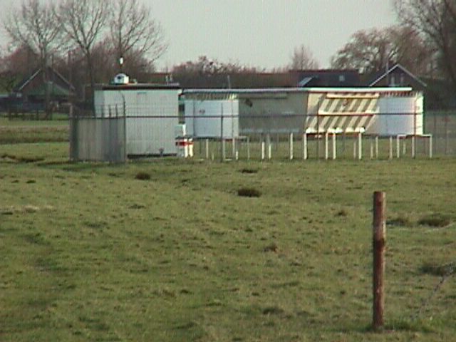
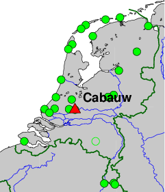
The Cabauw Experimental Site for Atmospheric Remote Sensing (CESAR), at Cabauw
(near Lopik), the Netherlands, is operated under responsability of KNMI. The site
hosts a large number of meteorological and atmospheric remote sensing sensors operated
by KNMI, RIVM, TU Delft, ESA, and others, such as
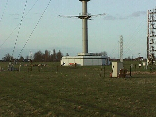
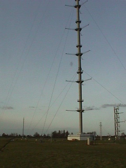
(water vapour) radiometers, Sun photometer, 213 meter mast with meteorological sensors,
wind profiler, radar, and a Raman Lidar.
On-site contact: Marcel Brinkenberg, KNMI
GNSS contact: Hans van der Marel, TUD/CITG/GRS
GNSS Instrument(s)
| Name | Marker | Receiver | Antenna | Operator | Network | Start date | End date |
|---|
| cabw | 13536M001X | TRIMBLE 5700 | ASH700936C_M | TUD/CITG/GRS | EGVAP,CESAR | 2001-08-06 | 2019-05-16 |
| cab1 | 13536M002 | ASHTECH Z-XII3 | ASH700936C_M | TUD/CITG/GRS | CESAR | 2005-07-20 | 2008-05-29 |
| cab2 | 13536M003 | SEPT POLARX4 | ASH700936C_M | TUD/CITG/GRS | CESAR | 2005-11-22 | 2020-02-27 |
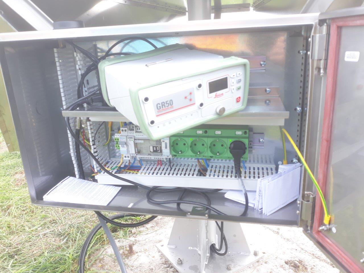
| cbw1 | 13536M001 | LEICA GR50 | LEIAR20 | NSGI | AGRS.NL,EGVAP,GRUAN,CESAR | 2019-05-16 | |
Markers
| ID | Name | dX | dY | dZ | Instruments | Installed | Removed |
|---|
| 13536M001 | Cabauw IGRS (GNSS ARP) | 0.0000 | 0.0000 | 0.0000 | cbw1 | 2019-05-16T10:00Z | |
| 13536M001X | Cabauw GPS (old) | 0.2520 | 0.0130 | 0.3840 | cabw | 2001-08-06T11:50Z | 2019-05-16T10:00Z |
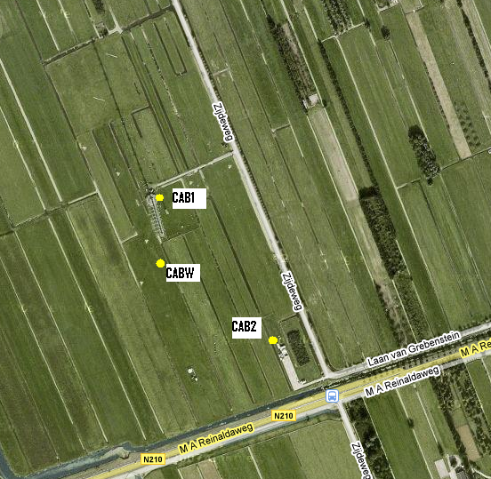
| 13536M002 | Cabauw Tower | 66.8900 | 3.9620 | 215.2610 | cab1 | 2005-07-20T09:00Z | 2008-05-29T10:00Z |
| 13536M003 | Cabauw RS | 96.9760 | 222.6230 | -90.0830 | cab2 | 2005-11-22T09:00Z | |
Pictures
Notes
- 2019-05-16T10:00Z 2053/4 136 -
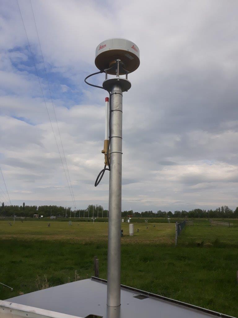
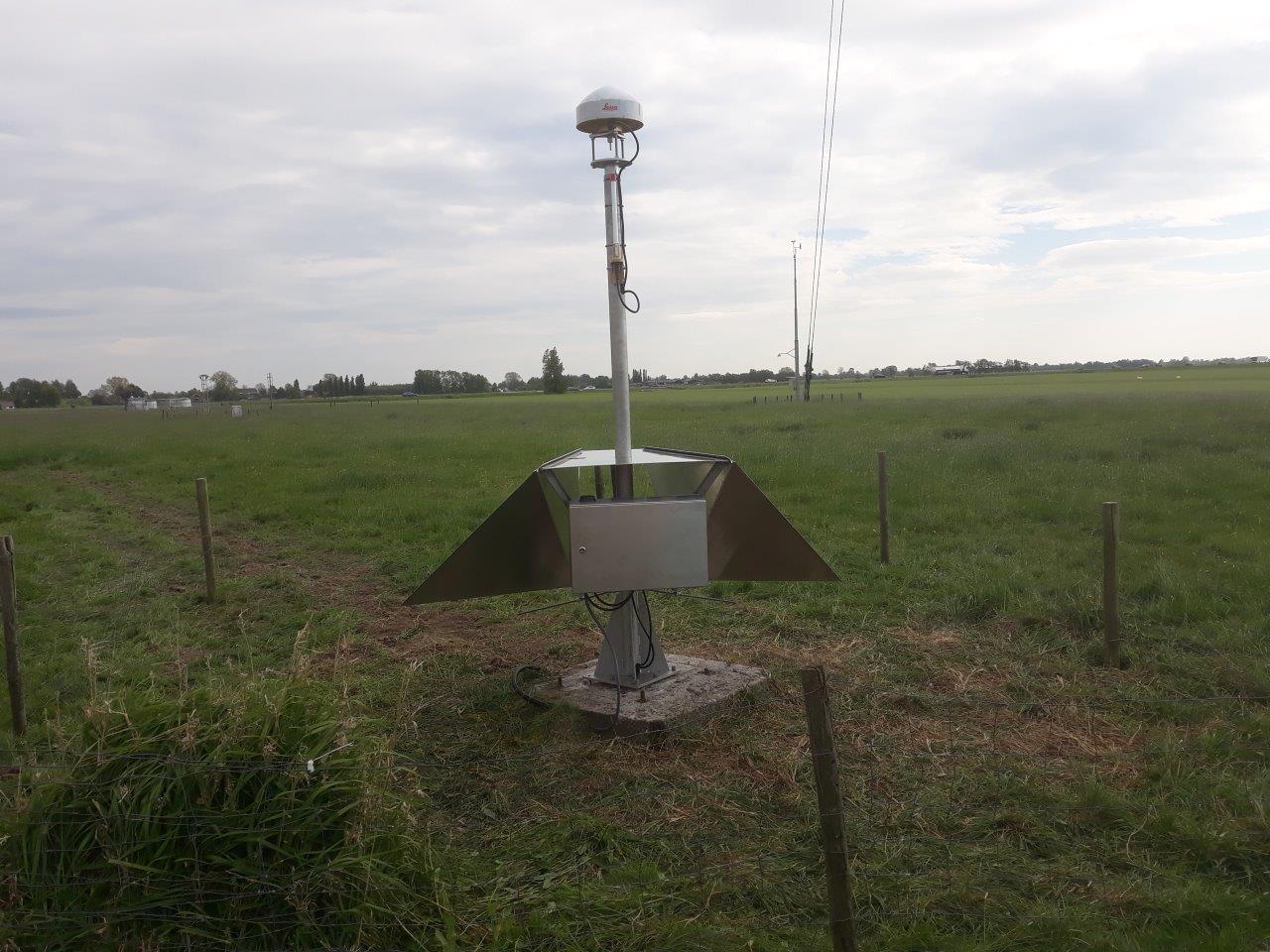
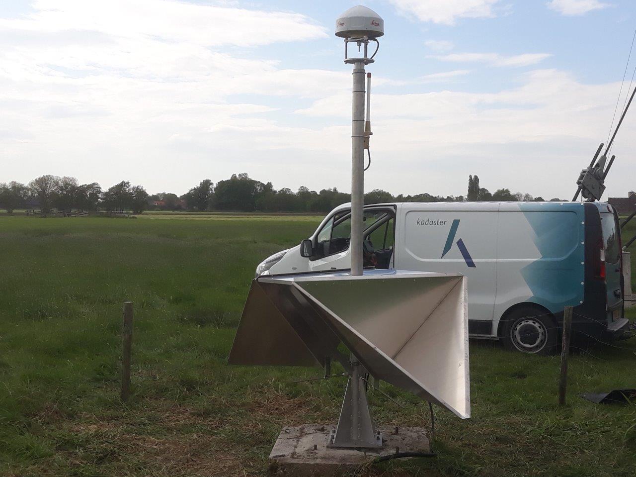
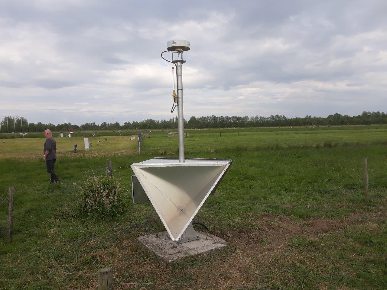
- The CABW monument was upgraded to geodetic quality by installing a so-called
Integrated Geodetic Reference Station, with ascending and descending InSAR
corner reflectors, on the concrete block that was previously used for the CABW
mast. The new monument and data stream have been given a new name to mark this
upgrade. The new name is CBW1. The CBW abbreviation is also in line with
the station identification used for meteorological sensors at the site.
The new monument is about 4 cm to the South, 1 cm to the East and 46 cm lower.
- 2001-01-15T00:00Z 1097/1 015 - 2019-05-16T10:00Z 2053/4 136
- The stability of the GPS CABW monument is good enough for atmospheric science, but
is not suitable for reference frame purposes or geophysical research as the long
term stability due to the soil, method of foundation and construction cannot be
guarantied.
- 2001-01-15T00:00Z 1097/1 015 - 2008-01-15T00:00Z 1462/2 015
- The official DOMES number 13536M___ was assigned by IERS on 2008-01-11. All RINEX files
until 2008-01-15 use the provisional DOMES number 13599M___ .
- 2001-01-15T00:00Z 1097/1 015 -
- The excentricities are only rough estimates. Final values need to be determined.
Active instruments
Marker ID: 13536M001
Operator: Kadaster
Log file:
cbw100nld_20240320.log
Receiver
| Installed | week/d doy | Removed | week/d doy | Receiver type | S/N | Firmware |
|---|
| 2019-05-16T15:00Z | 2053/4 136 | 2022-03-30T20:50Z | 2203/3 089 | LEICA GR50 | 1870649 | 4.31/7.403 |
| 2022-03-30T20:50Z | 2203/3 089 | 2024-03-20T08:09Z | 2306/3 080 | LEICA GR50 | 1870649 | 4.52/7.711 |
| 2024-03-20T08:09Z | 2306/3 080 | | | LEICA GR50 | 1870649 | 4.80/7.900 |
Antenna
| Installed | week/d doy | Removed | week/d doy | Antenna type | Dome | S/N | Height | Antenna calibration |
|---|
| 2019-05-16T15:00Z | 2053/4 136 | 2020-05-27T08:40Z | 2107/3 148 | LEIAR20 | LEIM | 20331002 | 0.0250 | |
| 2020-05-27T08:50Z | 2107/3 148 | | | LEIAR20 | LEIM | 20331002 | 0.0000 | |
External Frequency
| Installed | week/d doy | Removed | week/d doy | Ext. Frequency type |
|---|
| 2019-05-16T15:00Z | 2053/4 136 | | | INTERNAL |
Notes
- 2019-05-16T15:00Z 2053/4 136 - 2020-05-27T08:40Z 2107/3 148
- There was a temporary spacer between the pole and Kadaster mount putting the antenna effectively 2.5 cm above the designated marker. However, this was originally not reflected in
the RINEX header for data between May 2019 and May 27, 2020. On May 27, 2020, the antenna heights in the RINEX files have been corrected (0.0000 -> 0.0250). After May 27, 2020, 8:45 UTC, the antenna height
is zero.
- 2020-05-27T08:40Z 2107/3 148 - 2020-05-27T08:50Z 2107/3 148
- On May 27, 2020, the temporary spacer between the pole and Kadaster mount was replaced. The new spacer is 2.5 cm thick, instead of the 5 cm of the spacer use previously.
The Kadaster mount is now 2.5 cm lower than before and the antenna is now flush with the marker.
Discontinued instruments
Marker ID: 13536M001X
Operator: TU DELFT
Receiver
| Installed | week/d doy | Removed | week/d doy | Receiver type | S/N | Firmware |
|---|
| 2001-08-06T11:50Z | 1126/1 218 | 2002-02-19T13:00Z | 1154/2 050 | JPS LEGACY | 00143 | 2.2 |
| 2002-02-21T16:00Z | 1154/4 052 | 2015-06-25T00:00Z | 1850/4 176 | TRIMBLE 5700 | 70394 | N1.04/S0.00 |
| 2017-04-27T00:00Z | 1946/4 117 | 2019-05-16T09:00Z | 2053/4 136 | TRIMBLE 5700 | 70394 | N1.04/S0.00 |
Antenna
| Installed | week/d doy | Removed | week/d doy | Antenna type | Dome | S/N | Height | Antenna calibration |
|---|
| 2001-08-06T11:50Z | 1126/1 218 | 2002-02-19T13:00Z | 1154/2 050 | JPSREGANT_DD_E | NONE | 00098 | 2.1000 | JPSREGANT_DD_E1_NONE_ra0098.atx |
| 2002-02-21T16:00Z | 1154/4 052 | 2012-03-02T15:00Z | 1677/5 062 | TRM41249.00 | NONE | 82078 | 0.0533 | |
| 2012-03-17T12:00Z | 1679/6 077 | 2019-05-16T09:00Z | 2053/4 136 | ASH700936C_M | SNOW | 11994 | 0.0000 | |
External Frequency
| Installed | week/d doy | Removed | week/d doy | Ext. Frequency type |
|---|
| 2001-08-06T00:00Z | 1126/1 218 | 2019-05-16T09:00Z | 2053/4 136 | INTERNAL |
Notes
- 2001-08-06T11:50Z 1126/1 218 -
- In the RINEX files the marker name 13599M001 is used instead of the DOMES
number 13536M001 for historic reasons.
- 2011-01-25T14:00Z 1620/2 025 -
- A faulty antenna cable was replaced. There is a gap in the data from 2011-01-21T16:21Z until 2011-01-25T15:00Z.
- 2012-02-26T08:00Z 1677/0 057 - 2012-03-17T12:00Z 1679/6 077
- The mount of the Trimble Zephyr antenna was broken on 26 February 2012 just after 08:00 UTC due to corrosion.
The antenna, which was found hanging on the antenna cable, was removed on the 2nd of March 2012.
On the 17th of March 2012 a replacement mount and Ashtech Chokering antenna was installed. The original Trimble Zephyr
appears not to be working and has been replaced by another antenna type. The new antenna was not installed in the
same location: there is a offset and height change after the remount.
Marker ID: 13536M002
Operator: TU DELFT
Receiver
| Installed | week/d doy | Removed | week/d doy | Receiver type | S/N | Firmware |
|---|
| 2005-07-20T09:00Z | 1332/3 201 | 2006-01-16T11:00Z | 1358/1 016 | ASHTECH Z-XII3 | 00829 | 1L00/1D04 |
| 2006-01-16T11:00Z | 1358/1 016 | 2006-07-18T07:00Z | 1384/2 199 | ASHTECH Z-XII3 | 00823 | 1L00/1D04 |
| 2006-07-18T07:00Z | 1384/2 199 | 2007-05-21T09:30Z | 1428/1 141 | ASHTECH Z-XII3 | 00829 | 1L00/1D04 |
| 2007-05-21T12:30Z | 1428/1 141 | 2008-04-11T10:00Z | 1474/5 102 | ASHTECH Z-XII3 | 00829 | CD00/1D02 |
| 2008-04-11T10:00Z | 1474/5 102 | 2008-05-29T10:00Z | 1481/4 150 | ASHTECH Z-XII3 | 00823 | CD00/1D02 |
Antenna
| Installed | week/d doy | Removed | week/d doy | Antenna type | Dome | S/N | Height | Antenna calibration |
|---|
| 2005-07-20T09:00Z | 1332/3 201 | 2008-05-29T10:00Z | 1481/4 150 | ASH700936C_M | SNOW | 12109 | 0.0 | ASH700936C_M____SNOW_12109.atx |
External Frequency
| Installed | week/d doy | Removed | week/d doy | Ext. Frequency type |
|---|
| 2005-07-20T09:00Z | 1332/3 201 | 2008-05-29T10:00Z | 1481/4 150 | INTERNAL |
Notes
- 2005-07-20T09:00Z 1332/3 201 - 2008-05-29T10:00Z 1481/4 150
- In the RINEX files the marker name 13599M002 is used instead of the DOMES
number 13536M002 for historic reasons.
- 2005-07-20T09:00Z 1332/3 201 - 2007-05-22T00:00Z 1428/2 142
- In the RINEX files for this period wrong serial numbers for the receiver
and antenna were used.
- 2008-05-29T10:00Z 1481/4 150 -
- The receiver was stopped due to interference problems with the radar mounted on top of the mast.
Marker ID: 13536M003
Operator: TU DELFT
Receiver
| Installed | week/d doy | Removed | week/d doy | Receiver type | S/N | Firmware |
|---|
| 2005-11-22T09:00Z | 1350/2 326 | 2007-05-21T08:30Z | 1428/1 141 | ASHTECH Z-XII3 | 00837 | 1L00/1D04 |
| 2007-05-21T09:00Z | 1428/1 141 | 2016-06-23T00:00Z | 1902/4 175 | ASHTECH Z-XII3 | 00837 | CD00/1D02 |
| 2017-04-26T11:30Z | 1946/3 116 | 2018-11-15T14:30Z | 2027/4 319 | SEPT POLARX4 | 3102192 | 2.9.6 |
| 2018-11-15T14:30Z | 2027/4 319 | 2020-02-27T07:15Z | 2094/4 058 | SEPT POLARX4 | 3102192 | 2.9.6-patch2 |
Antenna
| Installed | week/d doy | Removed | week/d doy | Antenna type | Dome | S/N | Height | Antenna calibration |
|---|
| 2005-11-22T09:00Z | 1350/2 326 | 2020-02-27T07:15Z | 2094/4 058 | ASH700936C_M | SNOW | 12112 | 0.0 | |
External Frequency
| Installed | week/d doy | Removed | week/d doy | Ext. Frequency type |
|---|
| 2005-11-22T09:00Z | 1350/2 326 | 2020-02-27T07:15Z | 2094/4 058 | INTERNAL |
Notes
- 2019-05-17T08:30Z 2053/5 137 -
- On Friday 17 May, 2019, at about 8:30 UTC, one of the guy wires of the CAB2 stations
was damaged by a lawnmower. This resulted in a shift of about 41 mm to the South and 14 mm
to the East.
- 2005-11-22T09:00Z 1350/2 326 -
- In the RINEX files the marker name 13599M003 is used instead of the DOMES
number 13536M003 for historic reasons.
- 2005-11-22T09:00Z 1350/2 326 - 2006-01-19T23:59Z 1358/4 019
- In the RINEX files for this period wrong serial numbers for the receiver
and antenna were used.
For more information contact Hans van der Marel.

.jpg)
.jpg)
.jpg)
.jpg)
.jpg)
.jpg)
.jpg)
