Radar Cross Section (RCS)
The Radar Cross Section (RCS) of the IGRS is estimated from the Sentinel-1 and TSX data, and compared to the design RCS (computed by a raytracing algorithm). The design and estimated RCS is plotted versus the difference of the incidence angle with the boresight axis of the IGRS.
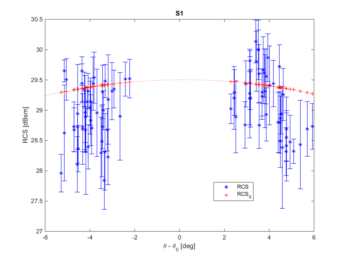
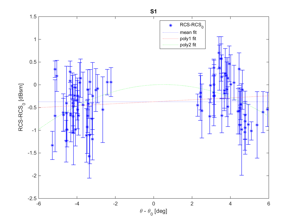
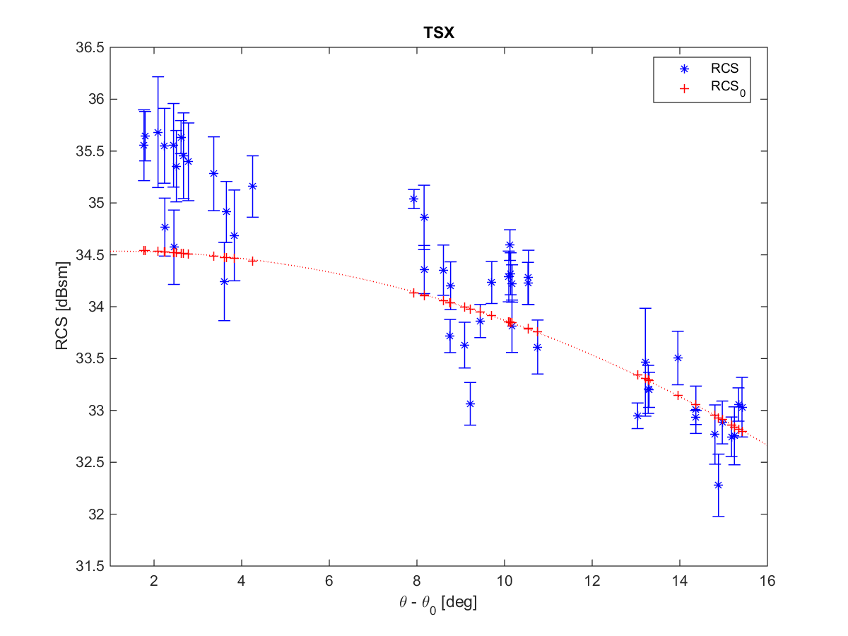
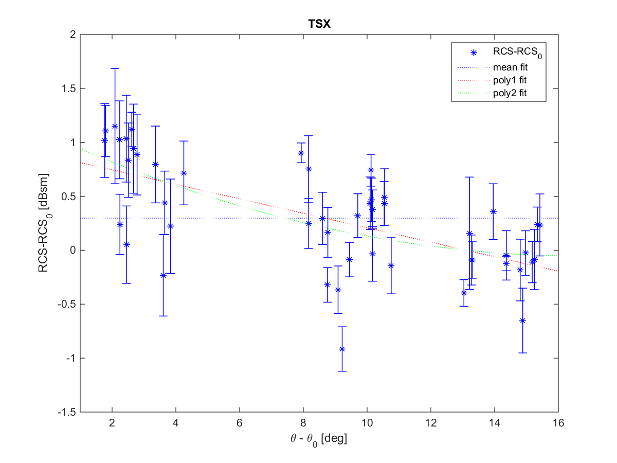
For boresight of the IGRS is aligned to the average of the incidence angles of Sentinel-1. Thus, for Sentinel-1 boresight is at the center of the plots, but for TSX, which has much lower incidence angles, the boresight is at the left of the plot. The reason the TSX theta angles are mainly positive is because the IGRS uses flipped triangular corner reflectors.